Latitude: 51.0659 / 51°3'57"N
Longitude: -1.7949 / 1°47'41"W
OS Eastings: 414464
OS Northings: 129634
OS Grid: SU144296
Mapcode National: GBR 51F.30L
Mapcode Global: FRA 7649.DK9
Plus Code: 9C3W3684+82
Entry Name: 10, the Close
Listing Date: 12 October 1972
Grade: II
Source: Historic England
Source ID: 1252031
English Heritage Legacy ID: 318969
ID on this website: 101252031
Location: The Friary, Wiltshire, SP1
County: Wiltshire
Civil Parish: Salisbury
Built-Up Area: Salisbury
Traditional County: Wiltshire
Lieutenancy Area (Ceremonial County): Wiltshire
Tagged with: Building
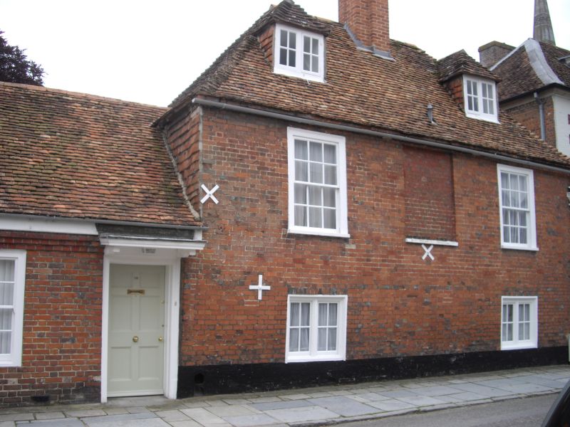
THE CLOSE
1.
1594 No 10
SU 1429 NW 3/52
II GV
2.
C18. 2 storeys and attic red brick. Steep hipped old tile roof central chimney
red brick, capped. 2 hipped dormers with 2 light casements. 3 windows, blind
to centre on 1st floor, flush architrave framed sashes, glazing bars intact.
2 small casements on ground floor and one fixed light. Single storey extension
to left one sash window, 2 doors one of 6 panels with flat bracketed hood,
the other plain.
All the listed buildings in the Close form an outstanding group.
Listing NGR: SU1446029632
External links are from the relevant listing authority and, where applicable, Wikidata. Wikidata IDs may be related buildings as well as this specific building. If you want to add or update a link, you will need to do so by editing the Wikidata entry.


Other nearby listed buildings