Latitude: 51.3439 / 51°20'37"N
Longitude: -2.148 / 2°8'52"W
OS Eastings: 389787
OS Northings: 160540
OS Grid: ST897605
Mapcode National: GBR 1SH.PRM
Mapcode Global: VH96X.QH94
Plus Code: 9C3V8VV2+GQ
Entry Name: Red Cross House
Listing Date: 29 January 1988
Grade: II
Source: Historic England
Source ID: 1252326
English Heritage Legacy ID: 435206
ID on this website: 101252326
Location: Semington, Wiltshire, BA14
County: Wiltshire
Civil Parish: Semington
Built-Up Area: Semington
Traditional County: Wiltshire
Lieutenancy Area (Ceremonial County): Wiltshire
Church of England Parish: Semington
Church of England Diocese: Salisbury
Tagged with: House
SEMINGTON HIGH STREET ST 86 SE (east side) 4/193 Red Cross House GV II
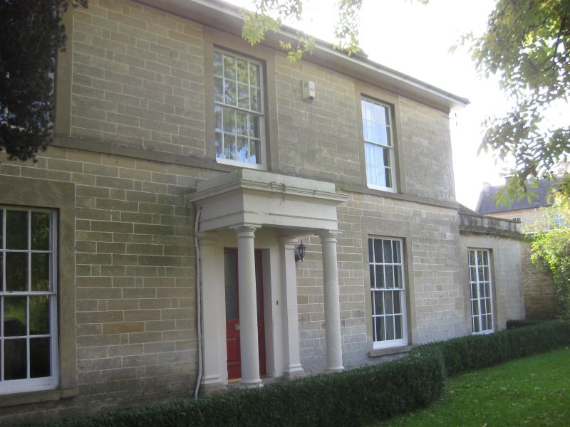
Detached house, now offices. Early C19. Limestone ashlar, hipped asbestos slate roof with gable end stone stacks with moulded cappings. L-plan. Two-storey, 3-window. Central 4-panelled door in Tuscan portico with 16-pane sashes either side. Plat band to sills of first floor windows; three 16-pane sashes. Left return has 16-pane sashes and 6-panelled door. Single-storey later C19 addition attached to right return. Rear, lower 2-storey service wing with 9-panelled door in moulded architrave with flat stone hood on brackets, 12-pane sashes. Interior has 6-panelled doors in moulded architraves, stairs with stick balusters, window shutters. Said to have been the rectory until c1960.
Listing NGR: ST8978760540
External links are from the relevant listing authority and, where applicable, Wikidata. Wikidata IDs may be related buildings as well as this specific building. If you want to add or update a link, you will need to do so by editing the Wikidata entry.


Other nearby listed buildings