Latitude: 54.1793 / 54°10'45"N
Longitude: -1.387 / 1°23'13"W
OS Eastings: 440109
OS Northings: 476118
OS Grid: SE401761
Mapcode National: GBR LNR3.JL
Mapcode Global: WHD8V.N6RX
Plus Code: 9C6W5JH7+P6
Entry Name: Dovecote 35 Metres East of Hall Farmhouse
Listing Date: 12 August 1993
Grade: II
Source: Historic England
Source ID: 1252491
English Heritage Legacy ID: 435492
ID on this website: 101252491
Location: Topcliffe, North Yorkshire, YO7
County: North Yorkshire
District: Hambleton
Civil Parish: Topcliffe
Traditional County: Yorkshire
Lieutenancy Area (Ceremonial County): North Yorkshire
Tagged with: Dovecote
TOPCLIFFE
SE 47 NW FRONT STREET (East side)
1439-/6/10000 Dovecote 35 metres east of Hall Farmhouse GV II
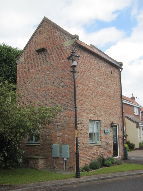
Dovecote. Late C18. Red brick with pantile roof. Raised brick gables with ashlar kneelers. Square plan. 2 storey. South front has a doorway to the right and a 2-light glazing bar sliding sash. The west front has a blocked doorway and above in the gable 2 flight holes with an ashlar flight perch. The north front has a further blocked doorway. The east front has a blank ground floor with above a loft doorway with plank door and above, in the gable 2 flight holes and an ashlar flight perch. Interior. The top floor contains many brick flight boxes.
Listing NGR: SE4010976118
External links are from the relevant listing authority and, where applicable, Wikidata. Wikidata IDs may be related buildings as well as this specific building. If you want to add or update a link, you will need to do so by editing the Wikidata entry.


Other nearby listed buildings