Approximate Location Map
Large Map »
Latitude: 51.3111 / 51°18'39"N
Longitude: -2.1351 / 2°8'6"W
OS Eastings: 390682
OS Northings: 156892
OS Grid: ST906568
Mapcode National: GBR 1SX.M20
Mapcode Global: VH973.Y94S
Plus Code: 9C3V8V67+CX
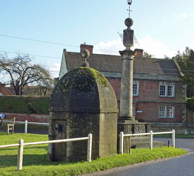
Entry Name: Blind House
Listing Date: 29 January 1988
Grade: II
Source: Historic England
Source ID: 1252512
English Heritage Legacy ID: 435508
ID on this website: 101252512
Location: Steeple Ashton, Wiltshire, BA14
County: Wiltshire
Civil Parish: Steeple Ashton
Built-Up Area: Steeple Ashton
Traditional County: Wiltshire
Lieutenancy Area (Ceremonial County): Wiltshire
Church of England Parish: Steeple Ashton
Church of England Diocese: Salisbury
Tagged with: House Village lock-up
STEEPLE ASHTON HIGH STREET
ST 9056
(east side)
13/238 Blind House
GV II
Blind house or lock-up. Probably early C18. Limestone ashlar.
Octagonal. Chamfered plinth, planked door with strap hinges on
north side, plat band to domed octagonal roof with ball finial to
apex. Good unaltered example of a Wiltshire blind house.
Scheduled Ancient Monument, Wiltshire No 251.
Listing NGR: ST9068256890
External links are from the relevant listing authority and, where applicable, Wikidata. Wikidata IDs may be related buildings as well as this specific building. If you want to add or update a link, you will need to do so by editing the Wikidata entry.


Other nearby listed buildings
