Latitude: 51.0379 / 51°2'16"N
Longitude: 0.5031 / 0°30'11"E
OS Eastings: 575587
OS Northings: 129484
OS Grid: TQ755294
Mapcode National: GBR PTX.VBS
Mapcode Global: FRA C6YC.MV2
Plus Code: 9F322GQ3+56
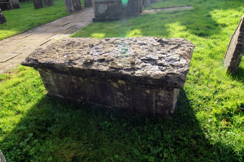
Entry Name: Chest Tomb to John Colletson, About 30 Metres North of Church of St Lawrence
Listing Date: 22 June 1989
Grade: II
Source: Historic England
Source ID: 1253109
English Heritage Legacy ID: 169730
ID on this website: 101253109
Location: St Laurence's Church, The Moor, Tunbridge Wells, Kent, TN18
County: Kent
District: Tunbridge Wells
Civil Parish: Hawkhurst
Built-Up Area: Hawkhurst
Traditional County: Kent
Lieutenancy Area (Ceremonial County): Kent
Tagged with: Chest tomb
HAWKHURST THE MOOR TQ 7429-7529 (south side) 18/380 Chest tomb to John Colletson, about 30 metres north of Church of St Lawrence GV II Chest tomb to John Colletson (d.1703) and inscribed on reverse to Constance, his wife, died early C18. Simple panelled sides, with double ogee moulded corner piers and reverse ogee moulded top slab, the base sunk into the ground.
Listing NGR: TQ7558729484
External links are from the relevant listing authority and, where applicable, Wikidata. Wikidata IDs may be related buildings as well as this specific building. If you want to add or update a link, you will need to do so by editing the Wikidata entry.


Other nearby listed buildings