Approximate Location Map
Large Map »
Latitude: 52.4214 / 52°25'16"N
Longitude: -1.6331 / 1°37'59"W
OS Eastings: 425048
OS Northings: 280438
OS Grid: SP250804
Mapcode National: GBR 5KJ.1YH
Mapcode Global: VHBWW.ND0M
Plus Code: 9C4WC9C8+GQ
Entry Name: Rock Farm
Listing Date: 3 February 1983
Grade: II
Source: Historic England
Source ID: 1253298
English Heritage Legacy ID: 436470
ID on this website: 101253298
Location: Four Oaks, Solihull, West Midlands, CV7
County: Solihull
Civil Parish: Berkswell
Traditional County: Warwickshire
Lieutenancy Area (Ceremonial County): West Midlands
Church of England Parish: Berkswell St John the Baptist
Church of England Diocese: Coventry
Tagged with: Agricultural structure
BACK LANE
1.
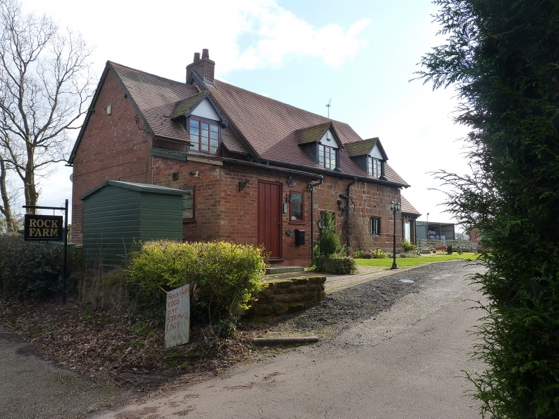
5108 BERKSWELL Rock Farm
SP 28 SE 16/395
II
2.
Cl7. Sandstone. Modern tile roof. One storey with attics. Chamfered plinth. Three
bays. Two-light mullioned windows. Gabled attic dormers. Chamfered door surround.
Roof truss partly visible in gable end.
Listing NGR: SP2504880438
External links are from the relevant listing authority and, where applicable, Wikidata. Wikidata IDs may be related buildings as well as this specific building. If you want to add or update a link, you will need to do so by editing the Wikidata entry.


Other nearby listed buildings
