Approximate Location Map
Large Map »
Latitude: 53.2979 / 53°17'52"N
Longitude: -2.7214 / 2°43'17"W
OS Eastings: 352014
OS Northings: 378124
OS Grid: SJ520781
Mapcode National: GBR 9ZF9.MJ
Mapcode Global: WH87Y.5CBM
Plus Code: 9C5V77XH+5C
Entry Name: Rock Villa
Listing Date: 17 May 1984
Grade: II
Source: Historic England
Source ID: 1253309
English Heritage Legacy ID: 436480
ID on this website: 101253309
Location: Newtown, Cheshire West and Chester, Cheshire, WA6
County: Cheshire West and Chester
Civil Parish: Frodsham
Built-Up Area: Frodsham
Traditional County: Cheshire
Lieutenancy Area (Ceremonial County): Cheshire
Church of England Parish: Frodsham St Lawrence
Church of England Diocese: Chester
Tagged with: Villa
FRODSHAM C.P. HIGH STREET
SJ 57 NW
(North Side)
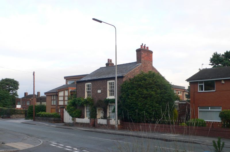
2/71 No. 67, Rock Villa.
17.5.84 II
Cottage, circa 1830. Flemish bond brown brick; grey slate roof. 2
storeys; 2 windows. 6-panel door, with fielded crosses in upper 4
panels and flush reeded lower panels, in moulded case with simple
entablature. Flush sashes under cambered skewback arches. Stone
steps to door.
Listing NGR: SJ5201478124
External links are from the relevant listing authority and, where applicable, Wikidata. Wikidata IDs may be related buildings as well as this specific building. If you want to add or update a link, you will need to do so by editing the Wikidata entry.


Other nearby listed buildings
