Approximate Location Map
Large Map »
Latitude: 51.6436 / 51°38'36"N
Longitude: -1.3062 / 1°18'22"W
OS Eastings: 448106
OS Northings: 194090
OS Grid: SU481940
Mapcode National: GBR 7YX.SQP
Mapcode Global: VHCY6.9YVF
Plus Code: 9C3WJMVV+CG
Entry Name: Water Standpipe
Listing Date: 11 April 1995
Grade: II
Source: Historic England
Source ID: 1253340
English Heritage Legacy ID: 361525
ID on this website: 101253340
Location: Drayton, Vale of White Horse, Oxfordshire, OX14
County: Oxfordshire
District: Vale of White Horse
Civil Parish: Drayton
Built-Up Area: Drayton
Traditional County: Berkshire
Lieutenancy Area (Ceremonial County): Oxfordshire
Church of England Parish: Drayton
Church of England Diocese: Oxford
Tagged with: Architectural structure
HIGH STREET
SU4894
1710-0/6/10002 (North side)
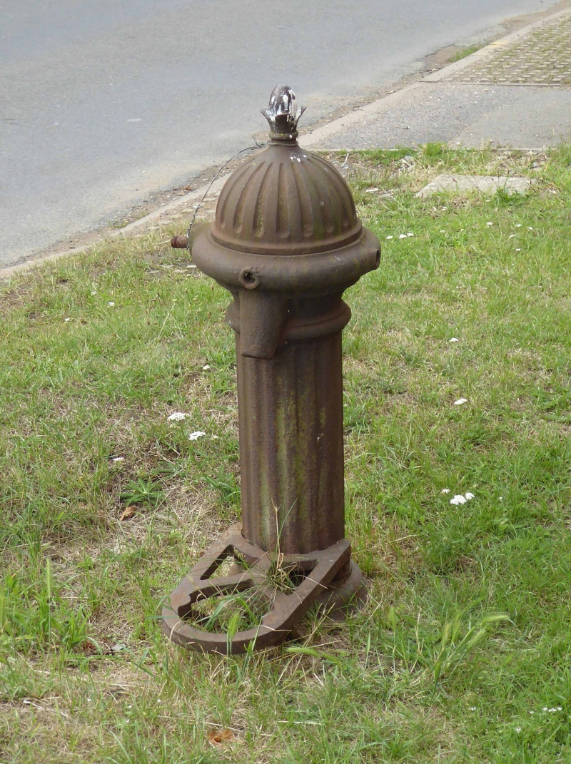
Water Stand-pipe
GV II
Water stand-pipe. Circa late C19. Cast-iron. In the form of a squat fluted column with a
moulded base and capital and a dome-shaped fluted cap with a finial. On the front of the
column is a small spout and a bucket-stand underneath.
Listing NGR: SU4810694090
External links are from the relevant listing authority and, where applicable, Wikidata. Wikidata IDs may be related buildings as well as this specific building. If you want to add or update a link, you will need to do so by editing the Wikidata entry.


Other nearby listed buildings
