Latitude: 52.9112 / 52°54'40"N
Longitude: -0.6404 / 0°38'25"W
OS Eastings: 491525
OS Northings: 335729
OS Grid: SK915357
Mapcode National: GBR DQ4.DWY
Mapcode Global: WHGKP.4391
Plus Code: 9C4XW965+FR
Entry Name: 8, St PETER'S HILL (See details for further address information)
Listing Date: 20 April 1972
Grade: II
Source: Historic England
Source ID: 1253725
English Heritage Legacy ID: 193007
ID on this website: 101253725
Location: Grantham, South Kesteven, Lincolnshire, NG31
County: Lincolnshire
District: South Kesteven
Electoral Ward/Division: Grantham St Wulfram's
Parish: Grantham
Built-Up Area: Grantham
Traditional County: Lincolnshire
Lieutenancy Area (Ceremonial County): Lincolnshire
Church of England Parish: Grantham St Wulfram
Church of England Diocese: Lincoln
Tagged with: Building
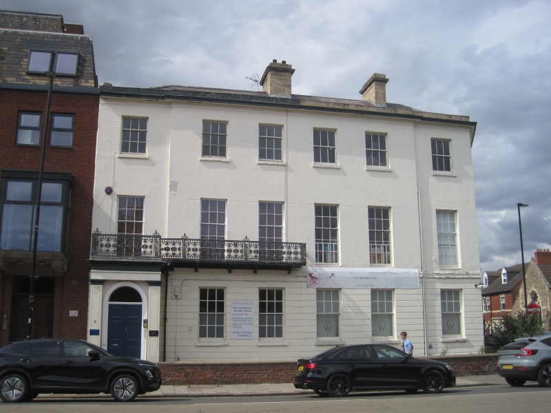
ST. PETER'S HILL 1. 1146 No. 8 SK 9135 NE 9/3 II 2. Includes No. 1 Castlegate, 2 houses, one composition, early C19, 3 - storey with basement; cemented front with stone cornice and parapet, hipped slate roof, ground floor rusticated; slightly projecting central block; 5 windows with glazing bars and slatted shutters on ground floor; balcony with cast-iron railing 1st floor porch at left. Pattern of balcony identical with that on Saracen's Head, Lincoln, also White Hart, Sleaford, as well as several private houses in the district, - also at Newark. Rear of house has plaque "1835 C. Holt".
Listing NGR: SK9152535729
External links are from the relevant listing authority and, where applicable, Wikidata. Wikidata IDs may be related buildings as well as this specific building. If you want to add or update a link, you will need to do so by editing the Wikidata entry.


Other nearby listed buildings