Approximate Location Map
Large Map »
Latitude: 54.4824 / 54°28'56"N
Longitude: -0.6081 / 0°36'29"W
OS Eastings: 490276
OS Northings: 510568
OS Grid: NZ902105
Mapcode National: GBR SJ6L.4Y
Mapcode Global: WHG9Y.MLMK
Plus Code: 9C6XF9JR+XQ
Entry Name: St Hildas Hospital
Listing Date: 4 December 1972
Grade: II
Source: Historic England
Source ID: 1253831
English Heritage Legacy ID: 437108
ID on this website: 101253831
Location: Fishburn Park, North Yorkshire, YO22
County: North Yorkshire
District: Scarborough
Civil Parish: Whitby
Built-Up Area: Whitby
Traditional County: Yorkshire
Lieutenancy Area (Ceremonial County): North Yorkshire
Church of England Parish: Whitby St Mary
Church of England Diocese: York
Tagged with: Hospital building
1.
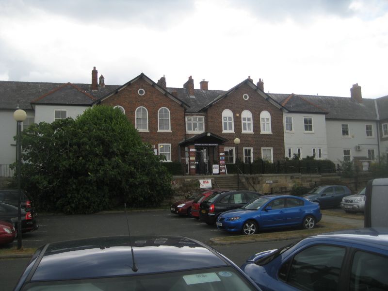
1811 THE ROPERY
St Hilda's Hospital
NZ 9010 9/169
II
2.
1793 and later. Built for use as a workhouse. Front elevation is of 2
storeys in brick. 6-3-3-6 windows, the central ones round-headed and the
roof brought forward as quasi open pedimented gables. Central round-headed
door with architrave. Slate roof with bell cote.
Listing NGR: NZ9027610568
External links are from the relevant listing authority and, where applicable, Wikidata. Wikidata IDs may be related buildings as well as this specific building. If you want to add or update a link, you will need to do so by editing the Wikidata entry.


Other nearby listed buildings
