Approximate Location Map
Large Map »
Latitude: 54.4877 / 54°29'15"N
Longitude: -0.6127 / 0°36'45"W
OS Eastings: 489970
OS Northings: 511142
OS Grid: NZ899111
Mapcode National: GBR SJ5K.42
Mapcode Global: WHG9Y.KGGK
Plus Code: 9C6XF9QP+3W
Entry Name: 8, Sandgate
Listing Date: 4 December 1972
Grade: II
Source: Historic England
Source ID: 1253977
English Heritage Legacy ID: 437290
ID on this website: 101253977
Location: Whitby, North Yorkshire, YO22
County: North Yorkshire
District: Scarborough
Civil Parish: Whitby
Built-Up Area: Whitby
Traditional County: Yorkshire
Lieutenancy Area (Ceremonial County): North Yorkshire
Church of England Parish: Whitby St Mary
Church of England Diocese: York
Tagged with: Building
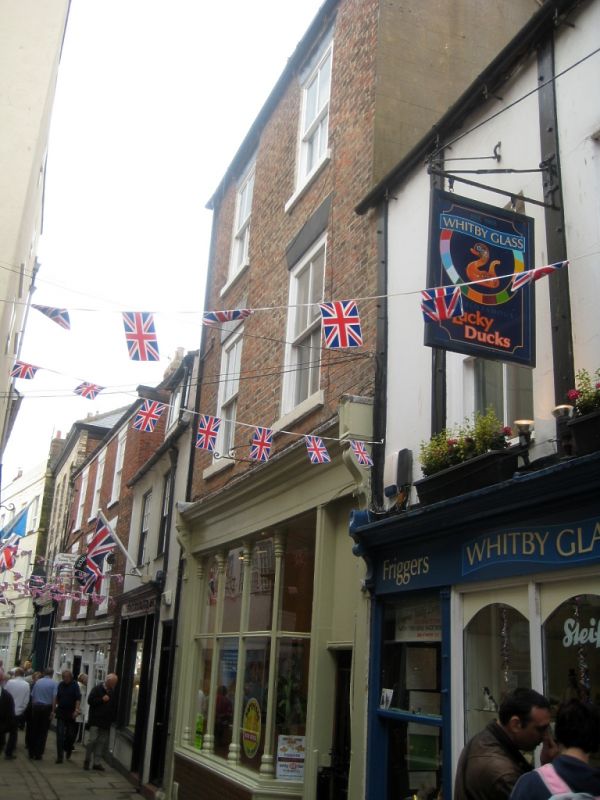
1.
1811 SANDGATE
(West Side)
No 8
NZ 8911 1/462
II GV
2.
C18 origin. 3 storeys in brick. Pantile roof. 2 windows, stone arches,
modern casements. Late C19 shop front.
All the listed buildings in Sandgate form a group.
Listing NGR: NZ8997011142
External links are from the relevant listing authority and, where applicable, Wikidata. Wikidata IDs may be related buildings as well as this specific building. If you want to add or update a link, you will need to do so by editing the Wikidata entry.


Other nearby listed buildings
