Approximate Location Map
Large Map »
Latitude: 51.2283 / 51°13'41"N
Longitude: 1.403 / 1°24'10"E
OS Eastings: 637689
OS Northings: 153181
OS Grid: TR376531
Mapcode National: GBR X1R.TTC
Mapcode Global: VHMDG.8DL7
Plus Code: 9F336CH3+86
Entry Name: 7, Griffin Street
Listing Date: 8 February 1974
Grade: II
Source: Historic England
Source ID: 1254127
English Heritage Legacy ID: 437528
ID on this website: 101254127
Location: Deal, Dover, Kent, CT14
County: Kent
District: Dover
Civil Parish: Deal
Built-Up Area: Deal
Traditional County: Kent
Lieutenancy Area (Ceremonial County): Kent
Tagged with: Building
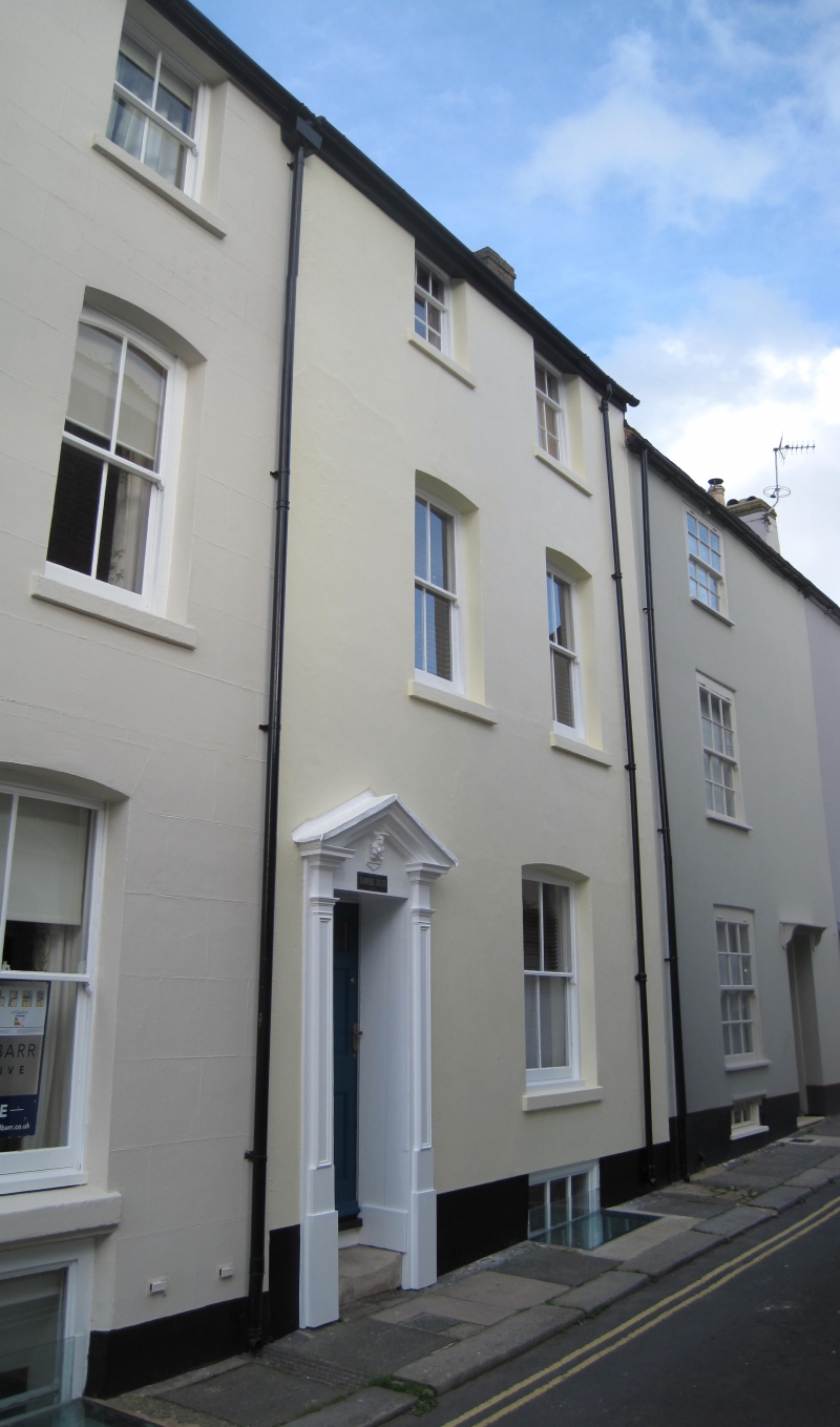
GRIFFIN STREET
1.
1035
(North Side)
No 7
TR 3753 SE 2/281
II GV
2.
Mid C19. 3 storeys and basement stuccoed. 2 sashes, mainly having vertical
glazing bars only. Cambered heads to lower floors. Left side doorcase with
open pediment and pilasters.
Nos 1 to 10 (consec) form a group.
Listing NGR: TR3768953181
External links are from the relevant listing authority and, where applicable, Wikidata. Wikidata IDs may be related buildings as well as this specific building. If you want to add or update a link, you will need to do so by editing the Wikidata entry.


Other nearby listed buildings
