Approximate Location Map
Large Map »
Latitude: 51.2284 / 51°13'42"N
Longitude: 1.404 / 1°24'14"E
OS Eastings: 637752
OS Northings: 153191
OS Grid: TR377531
Mapcode National: GBR X1R.V3F
Mapcode Global: VHMDG.9D26
Plus Code: 9F336CH3+8H
Entry Name: 12, Griffin Street
Listing Date: 8 February 1974
Grade: II
Source: Historic England
Source ID: 1254136
English Heritage Legacy ID: 437541
ID on this website: 101254136
Location: Deal, Dover, Kent, CT14
County: Kent
District: Dover
Civil Parish: Deal
Built-Up Area: Deal
Traditional County: Kent
Lieutenancy Area (Ceremonial County): Kent
Tagged with: Building
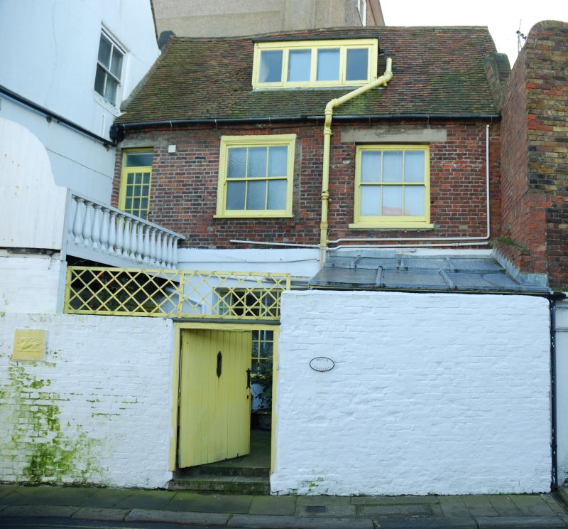
GRIFFIN STREET
1.
1035
(North Side)
No 12
TR 3753 SE 2/94
II GV
2.
C18. 2 storeys and attics red brick. Old tiled roof, half-hipped at 1 end.
1 curved pedimented dormer and casement. Elaborate wooden modillion cornice.
3 sashes set in moulded architraves with verticals only. Rainwater head. Central
doorcase with open pediment, plain pilasters, round-headed fanlight, panelled
reveals and 6 fielded panelled door.
Nos 11 and 12 form a group.
Listing NGR: TR3775253191
External links are from the relevant listing authority and, where applicable, Wikidata. Wikidata IDs may be related buildings as well as this specific building. If you want to add or update a link, you will need to do so by editing the Wikidata entry.


Other nearby listed buildings
