Latitude: 51.0008 / 51°0'2"N
Longitude: -2.2037 / 2°12'13"W
OS Eastings: 385800
OS Northings: 122395
OS Grid: ST858223
Mapcode National: GBR 1XP.1PW
Mapcode Global: FRA 668G.P94
Plus Code: 9C3V2Q2W+8G
Entry Name: Church of St James
Listing Date: 20 June 1952
Grade: II
Source: Historic England
Source ID: 1254409
English Heritage Legacy ID: 437905
ID on this website: 101254409
Location: St James's Church, St James, Dorset, SP7
County: Dorset
Civil Parish: Shaftesbury
Built-Up Area: Shaftesbury
Traditional County: Dorset
Lieutenancy Area (Ceremonial County): Dorset
Church of England Parish: Shaftesbury and Enmore Green St James
Church of England Diocese: Salisbury
Tagged with: Church building
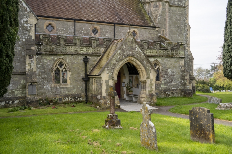
1.
12615 ST JAMES STREET
(South Side)
Church of St James
ST 8522 3/2 20.6.52.
B
2.
Rebuilt 1866-7. C14 style. Nave, chancel, North and South aisles. Some
pre-C19 wall tablets. West tower.
Listing NGR: ST8580022395
External links are from the relevant listing authority and, where applicable, Wikidata. Wikidata IDs may be related buildings as well as this specific building. If you want to add or update a link, you will need to do so by editing the Wikidata entry.


Other nearby listed buildings