Latitude: 53.4759 / 53°28'33"N
Longitude: -2.2396 / 2°14'22"W
OS Eastings: 384194
OS Northings: 397714
OS Grid: SJ841977
Mapcode National: GBR DKJ.RZ
Mapcode Global: WHB9G.KWRN
Plus Code: 9C5VFQG6+95
Entry Name: Former Electricity Power Station
Listing Date: 6 June 1994
Grade: II
Source: Historic England
Source ID: 1255031
English Heritage Legacy ID: 458617
ID on this website: 101255031
Location: Manchester, Greater Manchester, M1
County: Manchester
Electoral Ward/Division: City Centre
Parish: Non Civil Parish
Built-Up Area: Manchester
Traditional County: Lancashire
Lieutenancy Area (Ceremonial County): Greater Manchester
Church of England Parish: Manchester St Ann
Church of England Diocese: Manchester
Tagged with: Architectural structure
MANCHESTER
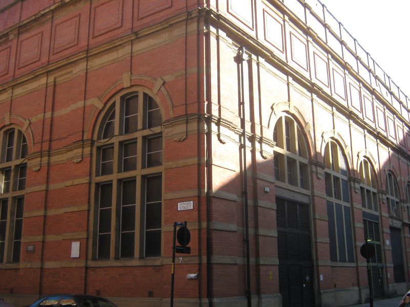
SJ8497NW WINSER STREET 698-1/32/444 (West side) Former Electricity Power Station
GV II
Electicity power generating station, now part electicity sub-station and part central-heating generator for the locality. 1901, altered. Red brick with sandstone dressings (roof not visible). Trapeziform plan on island site adjacent to Rochdale Canal and former canal basin immediately to rear. Five bays to Winser Street and 7 bays to Bloom Street. Industrial Baroque style. Regular aracaded facade to Bloom Street: stone-banded piers and giant round-headed arches with keystones, openings with large stone mullions and transoms, the 1st, 3rd and 5th wth louvred screens and the others blind or blocked; pilastered upper levels with cornices and parapet. Winser Street facade similar but less regular, with 3-window office in centre. Large octagonal chimney. Unusual survival of early example of local electricity station, and important functional component of this warehousing locality; forms part of group with No.102 and No.104 Bloom Street (q.v.), No.2 and No.12 Harter Street (q.v.) and Nos 54 and 56 Princess Street (q.v.).
Listing NGR: SJ8419497714
External links are from the relevant listing authority and, where applicable, Wikidata. Wikidata IDs may be related buildings as well as this specific building. If you want to add or update a link, you will need to do so by editing the Wikidata entry.


Other nearby listed buildings