Latitude: 52.7066 / 52°42'23"N
Longitude: -2.7511 / 2°45'3"W
OS Eastings: 349350
OS Northings: 312369
OS Grid: SJ493123
Mapcode National: GBR BJ.2HF0
Mapcode Global: WH8BT.Q75C
Plus Code: 9C4VP64X+JH
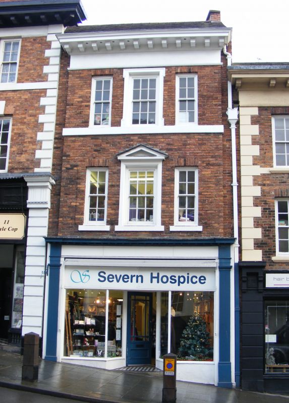
Entry Name: 12, Wyle Cop
Listing Date: 19 September 1972
Grade: II
Source: Historic England
Source ID: 1255099
English Heritage Legacy ID: 458411
ID on this website: 101255099
Location: Shrewsbury, Shropshire, SY1
County: Shropshire
Civil Parish: Shrewsbury
Built-Up Area: Shrewsbury
Traditional County: Shropshire
Lieutenancy Area (Ceremonial County): Shropshire
Church of England Parish: Shrewsbury St Chad
Church of England Diocese: Lichfield
Tagged with: Building
SHREWSBURY
SJ4912SW WYLE COP
653-1/15/703 (North side)
19/09/72 No.12
GV II
Shop. c1800. Brick with plain tiled roof. 3 storeys, narrow
3-window range. Early C20 shop front with fluted pilasters and
dentilled fascia. Central window above is a 12-pane sash with
pedimented head, outer windows 8-pane sashes with flat-arched
heads. Heavy modillion eaves cornice. Gable end stack rebuilt.
Listing NGR: SJ4935012369
External links are from the relevant listing authority and, where applicable, Wikidata. Wikidata IDs may be related buildings as well as this specific building. If you want to add or update a link, you will need to do so by editing the Wikidata entry.


Other nearby listed buildings