Latitude: 52.7067 / 52°42'24"N
Longitude: -2.7516 / 2°45'5"W
OS Eastings: 349312
OS Northings: 312377
OS Grid: SJ493123
Mapcode National: GBR BJ.2H8L
Mapcode Global: WH8BT.P7XB
Plus Code: 9C4VP64X+M9
Entry Name: 77 and 78, Wyle Cop
Listing Date: 10 January 1953
Grade: II
Source: Historic England
Source ID: 1255135
English Heritage Legacy ID: 458757
ID on this website: 101255135
Location: Shrewsbury, Shropshire, SY1
County: Shropshire
Civil Parish: Shrewsbury
Built-Up Area: Shrewsbury
Traditional County: Shropshire
Lieutenancy Area (Ceremonial County): Shropshire
Church of England Parish: Shrewsbury St Chad
Church of England Diocese: Lichfield
Tagged with: Building
SHREWSBURY
SJ4912SW WYLE COP 653-1/15/731 (South side) 10/01/53 Nos.77 AND 78
GV II
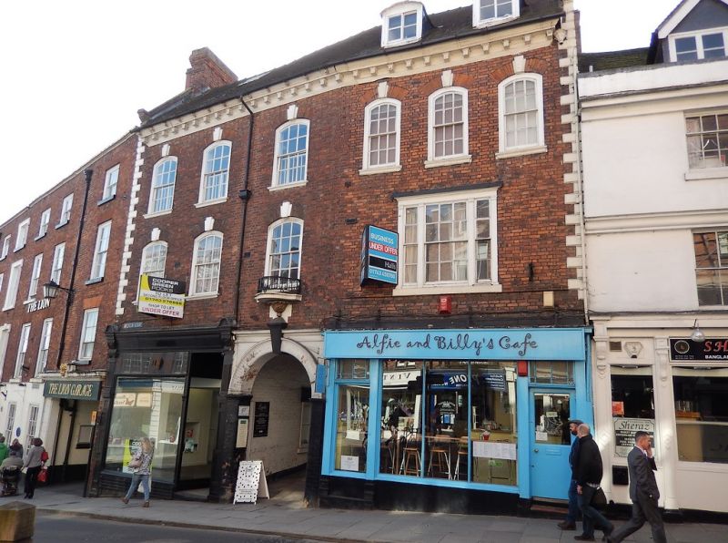
Pair of shops, probably originally 2 dwellings. c1730. Brick with plain tiled roof. 3 storeys and attic, 4-window range. Inserted shop fronts to ground floor each side of wide central segmental archway, with keystone capped by plaster urn, to passage to rear. Left-hand shop front is late C19, with elaborate consoles to fascia. 3 segmentally-arched 12-pane sash windows above, with gauged brick heads and stone keystones, and tripartite sash a later insertion to right. Central window over passageway has small balcony with cast-iron rails. 6 upper windows are all segmentally-arched 12-pane sashes with gauged brick heads and stone keystones. Angle quoins, modillion eaves cornice. Coped gables with moulded kneelers. Gable end stacks. Roof light in left-hand unit, 2 inserted or altered dormers to right. Rear wings with crow stepped gables, and mutilated datestone in gable apex, 173-.
Listing NGR: SJ4931212377
External links are from the relevant listing authority and, where applicable, Wikidata. Wikidata IDs may be related buildings as well as this specific building. If you want to add or update a link, you will need to do so by editing the Wikidata entry.


Other nearby listed buildings