Latitude: 52.9553 / 52°57'18"N
Longitude: -1.1493 / 1°8'57"W
OS Eastings: 457244
OS Northings: 340105
OS Grid: SK572401
Mapcode National: GBR LPN.8R
Mapcode Global: WHDGS.9ZY9
Plus Code: 9C4WXV42+47
Entry Name: 30, UPPER PARLIAMENT STREET (See details for further address information)
Listing Date: 30 November 1995
Grade: II
Source: Historic England
Source ID: 1255197
English Heritage Legacy ID: 458919
ID on this website: 101255197
Location: Nottingham, Nottinghamshire, NG1
County: City of Nottingham
Electoral Ward/Division: St Ann's
Parish: Non Civil Parish
Built-Up Area: Nottingham
Traditional County: Nottinghamshire
Lieutenancy Area (Ceremonial County): Nottinghamshire
Church of England Parish: Nottingham St Peter with St James
Church of England Diocese: Southwell and Nottingham
Tagged with: Building
NOTTINGHAM
SK5740SW UPPER PARLIAMENT STREET 646-1/14/657 (North side) No.30
GV II
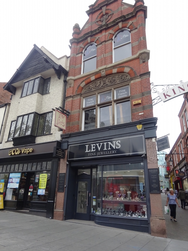
Includes: Nos.2 AND 4 KING'S WALK. Shops and offices. 1901, altered C20. By WD Pratt of Nottingham. Red brick with ashlar dressings. Corner block. Renaissance Revival style. 3 storeys plus attics; 1 x 4 bays. Altered shopfront with pink granite surround. Above, a cross mullioned window with decorated elliptical arched head and voussoirs. Above again, 2 round-arched plain sashes. Attic has a coped gable flanked by bartizans with finials, containing a small roundel. Right return has a doorway flanked by single shopfronts, all with rusticated surrounds under a cornice. Above, 4 elliptical arched recesses containing 6 plain sashes, and above again, 6 similar windows. These buildings are part of a development including east and west sides of King's Walk.
Listing NGR: SK5724440105
External links are from the relevant listing authority and, where applicable, Wikidata. Wikidata IDs may be related buildings as well as this specific building. If you want to add or update a link, you will need to do so by editing the Wikidata entry.


Other nearby listed buildings