Latitude: 53.8085 / 53°48'30"N
Longitude: -1.5565 / 1°33'23"W
OS Eastings: 429305
OS Northings: 434780
OS Grid: SE293347
Mapcode National: GBR BGG.7K
Mapcode Global: WHC9D.2J3P
Plus Code: 9C5WRC5V+9C
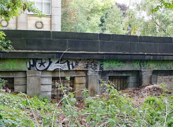
Entry Name: Facade to Burial Vaults Approximately 10 Metres South East of Chapel
Listing Date: 11 September 1996
Grade: II
Source: Historic England
Source ID: 1256135
English Heritage Legacy ID: 465210
ID on this website: 101256135
Location: St George's Fields, Woodhouse, Leeds, West Yorkshire, LS2
County: Leeds
Electoral Ward/Division: Hyde Park and Woodhouse
Parish: Non Civil Parish
Built-Up Area: Leeds
Traditional County: Yorkshire
Lieutenancy Area (Ceremonial County): West Yorkshire
Church of England Parish: Leeds St George
Church of England Diocese: Leeds
Tagged with: Burial vault
LEEDS
SE2934NW ST GEORGE'S FIELDS 714-1/71/363 Facade to burial vaults approximately 10m south-east of chapel
GV II
Remains of the facade to (probably) the burial vaults of the Leeds General Cemetery, now St George's Fields. 1832-34. By John Clark. Ashlar and gritstone. Approx 10m long and 2m high. 6 rusticated flat arches behind pilasters supporting entablature and cornice, 2-course parapet above. The arches are blocked. The facade is obscured by landscaping embankments at each end and was originally much longer. Baine's map of Leeds (1834) has an illustration of the 'General interior view of the Leeds Cemetery' which shows this facade with 48 openings or recesses and large terminals with statues; the 1847 OS map shows 'Arcade Vaults' of 32 bays, the central section built out and buttressed. (Baines and Newsome: Map of the Borough of Leeds: 1834-; Beresford, M: East End, West End: Face of Leeds During Urbanisation 1684-1842: Leeds: 1988-: 360-62; Ordnance Survey Map of Leeds: 1847-).
Listing NGR: SE2930534780
External links are from the relevant listing authority and, where applicable, Wikidata. Wikidata IDs may be related buildings as well as this specific building. If you want to add or update a link, you will need to do so by editing the Wikidata entry.


Other nearby listed buildings