Latitude: 53.9465 / 53°56'47"N
Longitude: -1.1039 / 1°6'13"W
OS Eastings: 458914
OS Northings: 450418
OS Grid: SE589504
Mapcode National: GBR NQQT.T0
Mapcode Global: WHFC9.02MC
Plus Code: 9C5WWVWW+JF
Entry Name: Hobs Stone at Ngr Se 589 504
Listing Date: 19 August 1971
Grade: II
Source: Historic England
Source ID: 1256501
English Heritage Legacy ID: 464853
ID on this website: 101256501
Location: South Bank, York, North Yorkshire, YO24
County: York
Electoral Ward/Division: Dringhouses & Woodthorpe
Parish: Non Civil Parish
Built-Up Area: York
Traditional County: Yorkshire
Lieutenancy Area (Ceremonial County): North Yorkshire
Church of England Parish: Dringhouses St Edward the Confessor
Church of England Diocese: York
Tagged with: Architectural structure
YORK
SE55SE TADCASTER ROAD 1112-1/1/1053 (West side (off)) 19/08/71 Hob's Stone at NGR SE 589 504
II
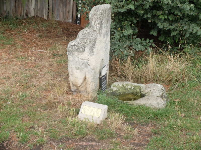
Coffin lid, later re-set in upright position. Probably early C14, with adjacent basin stone possibly C17 and with C18 inscription. Limestone. Upright stone approximately 0.4 metres by 0.5 metres and 1.0 metres high. West face has weathered effigy of a knight with a shield of arms. East face has C18 inscription, now worn and illegible. On the east side is a flat stone, with an upper face approximately 0.6 metres square with a shallow basin cut into it. Reputed to have been used for disinfecting money when the plague was in York. (An Inventory of the Historical Monuments of the City of York: RCHME: South-west of the Ouse: HMSO: 1972-: 58).
Listing NGR: SE5891450417
External links are from the relevant listing authority and, where applicable, Wikidata. Wikidata IDs may be related buildings as well as this specific building. If you want to add or update a link, you will need to do so by editing the Wikidata entry.


Other nearby listed buildings