Latitude: 50.5289 / 50°31'44"N
Longitude: -3.6113 / 3°36'40"W
OS Eastings: 285892
OS Northings: 71143
OS Grid: SX858711
Mapcode National: GBR QR.61VW
Mapcode Global: FRA 37BN.LY0
Plus Code: 9C2RG9HQ+HF
Entry Name: The Jolly Abbot Public House
Listing Date: 21 June 1977
Grade: II
Source: Historic England
Source ID: 1257079
English Heritage Legacy ID: 464246
Also known as: The Jolly Abbot
Jolly Abbot
The Jolly Abbot, Newton Abbot
ID on this website: 101257079
Location: Newton Abbot, Teignbridge, Devon, TQ12
County: Devon
District: Teignbridge
Civil Parish: Newton Abbot
Built-Up Area: Newton Abbot
Traditional County: Devon
Lieutenancy Area (Ceremonial County): Devon
Church of England Parish: Wolborough St Mary
Church of England Diocese: Exeter
Tagged with: Pub
NEWTON ABBOT
SX8571SE EAST STREET 1012-1/13/49 (South side) 21/06/77 Nos.16 AND 18 The Jolly Abbot public house
GV II
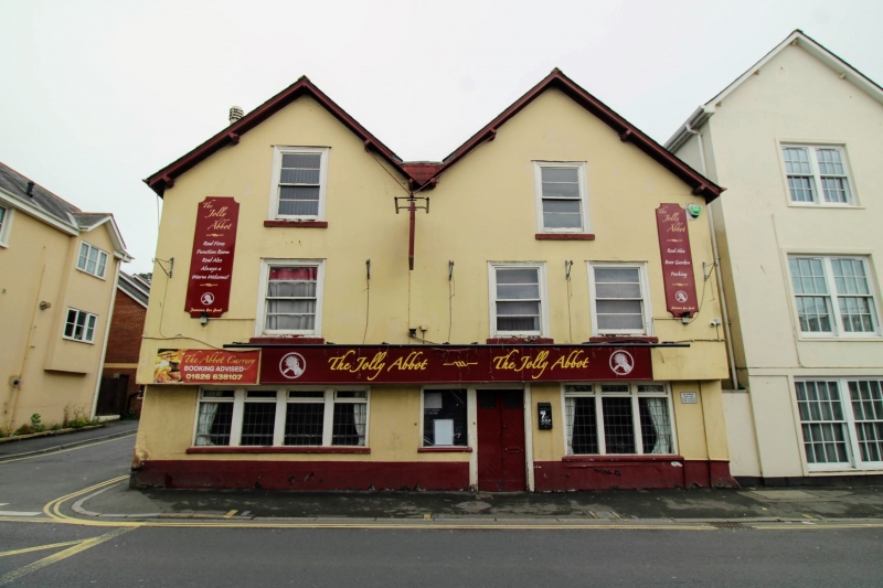
Inn now public house. C17, altered and extended C19, and C20. MATERIALS: painted render over a timber frame with rubblestone rear wings, double-pitched slate roof with forward-facing gables, brick stack to the left and 3 brick ridge stacks to the 2-storey rear left wing. PLAN: 2-unit plan with rear wings, that to the left lengthened in C19. EXTERIOR: 2 storeys with attics; 3-window range. Upper floors, jettied over the ground floor, have C19 moulded forward frames and horizontal glazing bars to 2/2-pane sash windows, one to each attic and to the first floor of the left-hand gable and two to the first floor of the right-hand gable. Ground floor has early C20 fixed windows with leaded lights. The left rear wing has 3 brick stacks and late C19 windows, the right return has C20 windows, the rear right wing has hipped roofs to a 2-storey and an added single-storey range. INTERIOR: the original 4-bay arched collar-beam roof structure with mortices for threaded purlins remains under a C19 higher-pitched gabled cladding. A large room to the first floor of the rear left wing has high coved ceiling, exposed studding to party wall of main block and panelled shutters. Ground floor is altered except for one chamfered beam to the rear left. C19 laundry equipment remains in the rear wing. HISTORY: the first meeting of the Wolborough Iron Mining Company is said to have taken place here about 1872. Augustus Smith, a great benefactor, identified the brown rock of Firestone Hill between Wolborough and Askerswell as haematite or iron ore. The Wolborough Iron Mine subsequently produced 1,240 tons of haematite during the years 1872-73. (Jones R: A Book of Newton Abbot: Callington: 1979-: 31).
Listing NGR: SX8589271142
External links are from the relevant listing authority and, where applicable, Wikidata. Wikidata IDs may be related buildings as well as this specific building. If you want to add or update a link, you will need to do so by editing the Wikidata entry.


Other nearby listed buildings