Approximate Location Map
Large Map »
Latitude: 53.9536 / 53°57'13"N
Longitude: -1.0982 / 1°5'53"W
OS Eastings: 459278
OS Northings: 451213
OS Grid: SE592512
Mapcode National: GBR NQSQ.1H
Mapcode Global: WHFC3.3WBG
Plus Code: 9C5WXW32+FP
Entry Name: Mount Terrace House
Listing Date: 1 July 1968
Last Amended: 14 March 1997
Grade: II
Source: Historic England
Source ID: 1257137
English Heritage Legacy ID: 464178
ID on this website: 101257137
Location: Holgate, York, North Yorkshire, YO24
County: York
Electoral Ward/Division: Micklegate
Parish: Non Civil Parish
Built-Up Area: York
Traditional County: Yorkshire
Lieutenancy Area (Ceremonial County): North Yorkshire
Church of England Parish: York St Paul
Church of England Diocese: York
Tagged with: House
YORK
SE5951SW MOUNT TERRACE
1112-1/19/766 No.6
01/07/68 Mount Terrace House
(Formerly Listed as:
MOUNT TERRACE
Nos.1, 2-5, AND 6 (Consecutive))
GV II
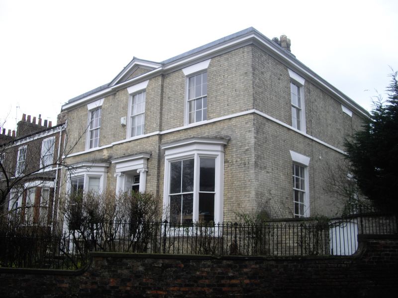
House. c1827; later C19 alteration. White brick. Slate roof
behind parapet. Double-depth plan.
EXTERIOR: facade symmetrical, of 2 storeys above a cellar and
3 bays, with a cornice and blocking course. The central bay
projects slightly under a pediment. The 1st floor windows are
glazing bar sashes with a sill band and painted brick flat
arches. On the ground floor there are sashed canted bay
windows with moulded cornices. The right-hand one has a brick
base, and the base of the left-hand one has a mullioned cellar
window. The doorcase has engaged Ionic columns, a cornice, and
panelled reveals. Above the 6-panel door there is an overlight
with geometrical glazing. Chimneys to left and right. The
right-hand return wall, facing north-west, is of 2 bays and
has sashed windows with painted brick flat arches, except at
the right on the 1st floor where there is a blind recess.
INTERIOR: not inspected.
(An Inventory of the Historical Monuments of the City of York:
RCHME: South-west of the Ouse: HMSO: 1972-: 128).
Listing NGR: SE5927851213
External links are from the relevant listing authority and, where applicable, Wikidata. Wikidata IDs may be related buildings as well as this specific building. If you want to add or update a link, you will need to do so by editing the Wikidata entry.


Other nearby listed buildings
