Latitude: 53.9499 / 53°56'59"N
Longitude: -1.0753 / 1°4'31"W
OS Eastings: 460781
OS Northings: 450817
OS Grid: SE607508
Mapcode National: GBR NQXR.ZT
Mapcode Global: WHFC3.GZ5B
Plus Code: 9C5WWWXF+XV
Entry Name: The Lodge
Listing Date: 19 August 1971
Grade: II
Source: Historic England
Source ID: 1257701
English Heritage Legacy ID: 463556
ID on this website: 101257701
Location: Clementhorpe, York, North Yorkshire, YO10
County: York
Electoral Ward/Division: Fishergate
Parish: Non Civil Parish
Built-Up Area: York
Traditional County: Yorkshire
Lieutenancy Area (Ceremonial County): North Yorkshire
Church of England Parish: Fulford St Oswald
Church of England Diocese: York
Tagged with: Gatehouse
YORK
SE6050NE GRANGE GARTH 1112-1/25/426 (West side) 19/08/71 No.2 The Lodge
II
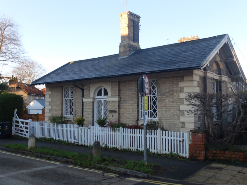
Formerly known as: The Lodge under Grange Croft GRANGE GARTH. Lodge, now house. c1835. Gault brick with painted stone or stucco dressings. Slate roof. EXTERIOR: single storey. Symmetrical, with one bay to each side of a central entrance. The facade has moulded quoins with sunken panels, a plinth, and an eaves band. The windows have recessed panels below painted sills and are sashed with lattice glazing bars and margin panes. The doorway is set within a brick panel which projects slightly, and has a semicircular painted stone or stucco moulded arch and impost band. The partly-glazed divided door has margin panes and lattice glazing bars. The semicircular overlight has a central division. At the eaves the roof projects on sprocketed rafters. Central ridge chimney with 2 square brick shafts and single stone cap. The gable walls, facing north and south, are treated in a similar manner, with a plinth, quoins, and with the eaves band continued as a lintel band. Each has brickwork which projects forwards slightly at the centre of the wall, and has a single sash window matching those at the front, set within a round-headed recess. INTERIOR: not inspected. HISTORICAL NOTE: built as a lodge to The Grange, now Fulford Grange and The Croft (qv). (An Inventory of the Historical Monuments of the City of York: RCHME: Outside the City Walls East of the Ouse: HMSO: 1975-: 71).
Listing NGR: SE6078150817
External links are from the relevant listing authority and, where applicable, Wikidata. Wikidata IDs may be related buildings as well as this specific building. If you want to add or update a link, you will need to do so by editing the Wikidata entry.


Other nearby listed buildings