Latitude: 53.2585 / 53°15'30"N
Longitude: -1.9145 / 1°54'52"W
OS Eastings: 405799
OS Northings: 373508
OS Grid: SK057735
Mapcode National: GBR HZ2R.9M
Mapcode Global: WHBBS.KCJ8
Plus Code: 9C5W735P+C5
Entry Name: St Anns Well
Listing Date: 31 January 1997
Grade: II
Source: Historic England
Source ID: 1257868
English Heritage Legacy ID: 463339
Also known as: St Ann's Well
ID on this website: 101257868
Location: Buxton, High Peak, Derbyshire, SK17
County: Derbyshire
District: High Peak
Electoral Ward/Division: Buxton Central
Parish: Non Civil Parish
Built-Up Area: Buxton
Traditional County: Derbyshire
Lieutenancy Area (Ceremonial County): Derbyshire
Church of England Parish: Buxton with Burbage and King Sterndale
Church of England Diocese: Derby
Tagged with: Well
BUXTON
SK0573NE THE CRESCENT 616-1/3/78 (South West side) St Ann's Well
GV II
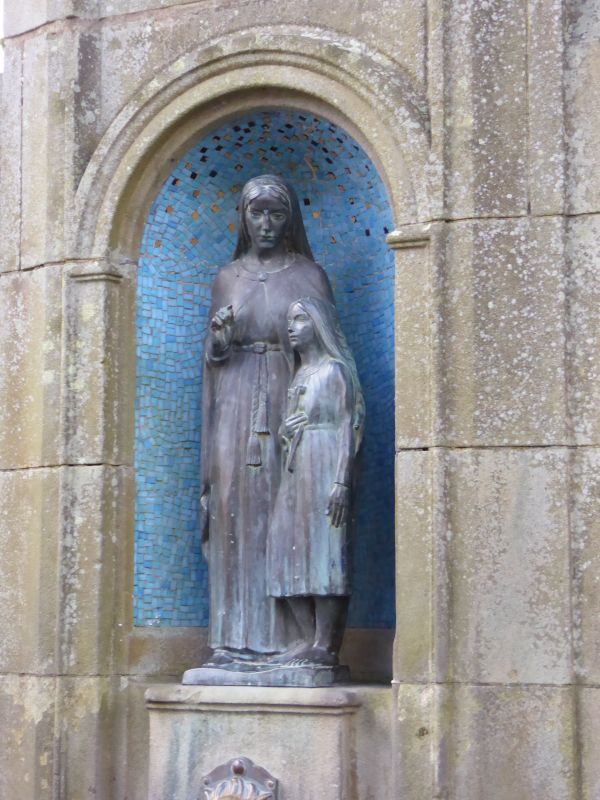
Drinking well. c1940, on site of earlier wells dating back to the Roman period. Ashlar gritstone with ashlar dressings, marble trough, plinth and stand, bronze figures. Rectangular base with tall square ashlar pier flanked by lower set back piers with moulded plinth and topped with convex coping. Front has shaped centre panel with round headed niche with mosaic inlay, containing 2 bronze figures, St Ann and child. Above is inscription A TRIBUTE/ TO THE MEMORY OF/ EMELIE DOROTHY BOUNDS/ COUNCILLOR OF THIS BOROUGH/ by her husband and daughter. Below is a bronze lion's head delivering water into the projecting rectangular marble trough on pedestal stand. Included for group value as an important element of The Crescent.
Listing NGR: SK0579973508
External links are from the relevant listing authority and, where applicable, Wikidata. Wikidata IDs may be related buildings as well as this specific building. If you want to add or update a link, you will need to do so by editing the Wikidata entry.


Other nearby listed buildings