Approximate Location Map
Large Map »
Latitude: 52.8296 / 52°49'46"N
Longitude: -2.208 / 2°12'28"W
OS Eastings: 386082
OS Northings: 325809
OS Grid: SJ860258
Mapcode National: GBR 16F.LLQ
Mapcode Global: WHBDS.14VK
Plus Code: 9C4VRQHR+VR
Entry Name: Milepost Stafford Newport Road 5 Miles from Stafford
Listing Date: 10 January 1972
Grade: II
Source: Historic England
Source ID: 1258135
English Heritage Legacy ID: 444409
ID on this website: 101258135
Location: Stafford, Staffordshire, ST18
County: Staffordshire
District: Stafford
Civil Parish: Seighford
Traditional County: Staffordshire
Lieutenancy Area (Ceremonial County): Staffordshire
Church of England Parish: Seighford St Chad
Church of England Diocese: Lichfield
Tagged with: Milestone
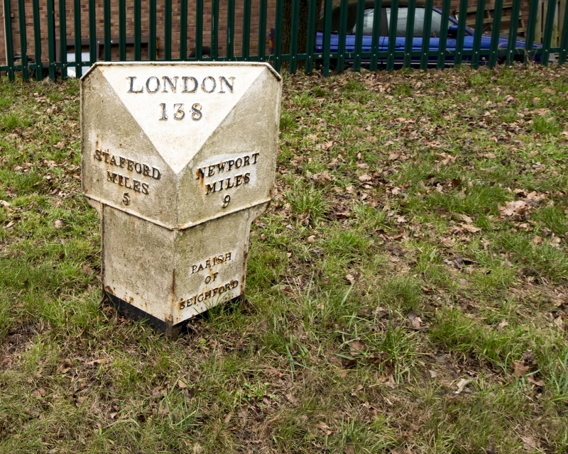
SEIGHFORD
1.
2385
Milepost
Stafford-Newport Road
(B5405) 5 miles from
Stafford
SJ 82 NE 12/22
II
2.
Mid C19 painted cast iron mile post, lettered "Parish of Seighford" and
giving the distance from Stafford, Newport and London.
Listing NGR: SJ8608325808
External links are from the relevant listing authority and, where applicable, Wikidata. Wikidata IDs may be related buildings as well as this specific building. If you want to add or update a link, you will need to do so by editing the Wikidata entry.


Other nearby listed buildings
