Latitude: 53.6381 / 53°38'17"N
Longitude: -1.4958 / 1°29'44"W
OS Eastings: 433434
OS Northings: 415854
OS Grid: SE334158
Mapcode National: GBR KVZC.YK
Mapcode Global: WHDCB.0T09
Plus Code: 9C5WJGQ3+7M
Entry Name: 23, Hill Top
Listing Date: 1 February 1979
Grade: II
Source: Historic England
Source ID: 1258148
English Heritage Legacy ID: 444438
ID on this website: 101258148
Location: Hill Top, Wakefield, West Yorkshire, WF2
County: Wakefield
Electoral Ward/Division: Wakefield South
Parish: Non Civil Parish
Built-Up Area: Wakefield
Traditional County: Yorkshire
Lieutenancy Area (Ceremonial County): West Yorkshire
Church of England Parish: Sandal Magna St Helen
Church of England Diocese: Leeds
Tagged with: Building
1. HILL TOP ROAD 5115 (North Side) Newmillerdam No 23 SE 3315 9/11
II
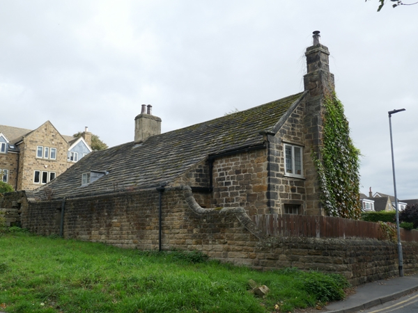
2. C17 or early C18 house with gable end to road. 2.storeys, 4 windows, irregular. Roughly coursed squared tooled stone with large quoins. Moderately high pitched stone flagged roof with left and centre chimneys, stone and rendered. One 1st floor stone-mullioned window with chamfered reveal; and two other similar reveals, but mullions removed. Ground floor windows altered but retain jambs. 6-panel door with stone lintel and monolith jambs; and an inserted door at right. Long rear lean-to, with a small dormer, seems contemporary with house.
Listing NGR: SE3343415854
External links are from the relevant listing authority and, where applicable, Wikidata. Wikidata IDs may be related buildings as well as this specific building. If you want to add or update a link, you will need to do so by editing the Wikidata entry.


Other nearby listed buildings