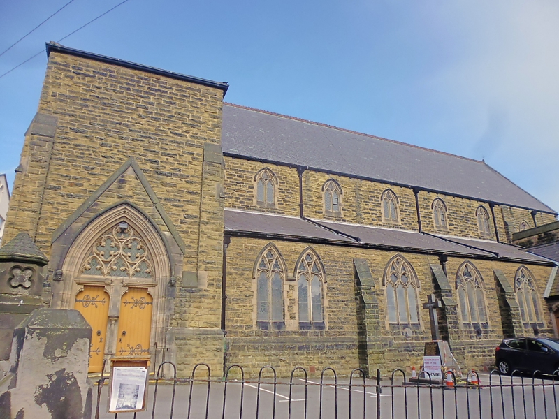
Latitude: 54.2863 / 54°17'10"N
Longitude: -0.3975 / 0°23'51"W
OS Eastings: 504415
OS Northings: 489034
OS Grid: TA044890
Mapcode National: GBR TLNW.Q7
Mapcode Global: WHGC0.VJWF
Plus Code: 9C6X7JP2+GX
Entry Name: Roman Catholic Church of St Peter
Listing Date: 8 June 1973
Grade: II
Source: Historic England
Source ID: 1258161
English Heritage Legacy ID: 444461
Also known as: St Peter's Church, Scarborough
ID on this website: 101258161
Location: Scarborough, North Yorkshire, YO11
County: North Yorkshire
District: Scarborough
Electoral Ward/Division: Castle
Parish: Scarborough
Built-Up Area: Scarborough
Traditional County: Yorkshire
Lieutenancy Area (Ceremonial County): North Yorkshire
Church of England Parish: Scarborough St Mary
Church of England Diocese: York
Tagged with: Church building
1. CASTLE ROAD 1605 (South Side ) Roman Catholic Church of St Peter TA 0489 2/214
II
2. 1858 by Goldie of Weightman, Hadfield and Goldie, large severe coursed stone rubble church, not orientated. 2 light window with Decorated and geometrical tracery. Buttressed aisles and clerestory. Windowless polygonal apse, the first church according to Eastlake to have this feature. Low square tower set at north end next to apse. Porch to side at north end with elaborate tracery above door. Large 5 light north window. Paintings in sanctuary by Goldie.
Listing NGR: TA0441589034
External links are from the relevant listing authority and, where applicable, Wikidata. Wikidata IDs may be related buildings as well as this specific building. If you want to add or update a link, you will need to do so by editing the Wikidata entry.


Other nearby listed buildings