Latitude: 53.652 / 53°39'7"N
Longitude: -1.4904 / 1°29'25"W
OS Eastings: 433778
OS Northings: 417400
OS Grid: SE337174
Mapcode National: GBR LV16.3L
Mapcode Global: WHDCB.2GKN
Plus Code: 9C5WMG25+RR
Entry Name: Milnthorpe Grange
Listing Date: 1 February 1979
Grade: II
Source: Historic England
Source ID: 1258252
English Heritage Legacy ID: 444640
ID on this website: 101258252
Location: Milnthorpe, Wakefield, West Yorkshire, WF2
County: Wakefield
Electoral Ward/Division: Wakefield South
Parish: Non Civil Parish
Built-Up Area: Wakefield
Traditional County: Yorkshire
Lieutenancy Area (Ceremonial County): West Yorkshire
Church of England Parish: Sandal Magna St Helen
Church of England Diocese: Leeds
Tagged with: Building
1. MILNTHORPE LANE 5115 (North Side) Sandal No 409 (Milnthorpe Grange) SE 3317 8/202
II
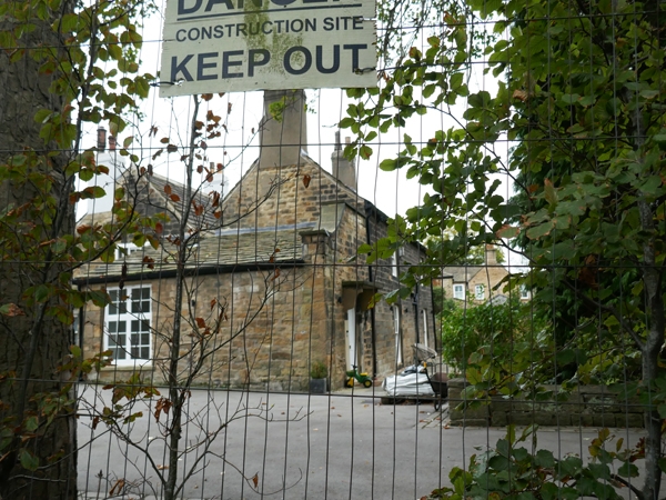
2. Complicated house of three builds with small later additions. All of coursed, squared stone. North-west part of circa 1700. 2-storeys, two bays, low proportions and a high pitched swept roof of large flags. Parallel range to south-west with an L running north-eastwards bears a datestone of 1749 but has had alterations. Two wide bays on main front, later C19 sash windows in raised surrounds. Roof of graduated stone flags hipped at right around L. Space between these ranges has been roofed to form a passage, and a pent porch added to north-west. North-east wing added to L circa 1800 has sash windows with glazing bars, four and five panes wide, in plain reveals. Flagged roof of lower pitch. This abuts on the outbuilding of early-mid C19 date, similar materials. Many exposed beams inside and one room with chamfered beam and joists. Simple C18 staircase ith turned balusters and cut string.
Listing NGR: SE3377817400
External links are from the relevant listing authority and, where applicable, Wikidata. Wikidata IDs may be related buildings as well as this specific building. If you want to add or update a link, you will need to do so by editing the Wikidata entry.


Other nearby listed buildings