Latitude: 51.0681 / 51°4'5"N
Longitude: -1.7964 / 1°47'47"W
OS Eastings: 414360
OS Northings: 129883
OS Grid: SU143298
Mapcode National: GBR 517.W3N
Mapcode Global: FRA 7639.CYG
Plus Code: 9C3W3693+6C
Entry Name: 47, New Canal
Listing Date: 28 February 1952
Last Amended: 12 October 1972
Grade: II
Source: Historic England
Source ID: 1258299
English Heritage Legacy ID: 444733
ID on this website: 101258299
Location: Salisbury, Wiltshire, SP1
County: Wiltshire
Civil Parish: Salisbury
Built-Up Area: Salisbury
Traditional County: Wiltshire
Lieutenancy Area (Ceremonial County): Wiltshire
Church of England Parish: Salisbury St Thomas and St Edmund
Church of England Diocese: Salisbury
Tagged with: Building
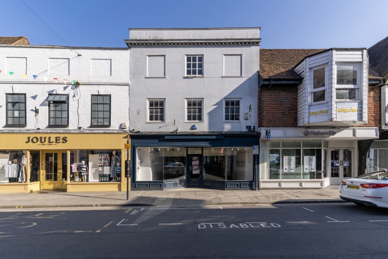
NEW CANAL
1.
1594 (South Side)
No 47
SU 1429 NW 3/91A 28.2.52.
II GV
2.
(Formerly listed with Nos 49-5l). C18 front to earlier building, 3 storeys
stucco faced, cornice and parapet. 3 windows to upper floors, outer one
blind on 2nd floor, flush framed sashes. Modern ship on ground floor.
Nos 45 to 51 (odd) form a group.
Listing NGR: SU1436029883
External links are from the relevant listing authority and, where applicable, Wikidata. Wikidata IDs may be related buildings as well as this specific building. If you want to add or update a link, you will need to do so by editing the Wikidata entry.


Other nearby listed buildings