Latitude: 51.4174 / 51°25'2"N
Longitude: 0.7439 / 0°44'38"E
OS Eastings: 590890
OS Northings: 172282
OS Grid: TQ908722
Mapcode National: GBR RSF.2WV
Mapcode Global: VHKJ6.VM4S
Plus Code: 9F32CP8V+XH
Entry Name: Church House
Listing Date: 19 October 1951
Grade: II
Source: Historic England
Source ID: 1258420
English Heritage Legacy ID: 444944
ID on this website: 101258420
Location: Queenborough, Swale, Kent, ME11
County: Kent
District: Swale
Civil Parish: Queenborough
Built-Up Area: Queenborough
Traditional County: Kent
Lieutenancy Area (Ceremonial County): Kent
Tagged with: House
HIGH STREET 1. 5282 (North Side) Queenborough No 76 TQ 9072 SE 1/65 19.10.51. (Church House)
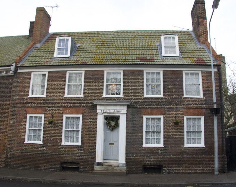
II GV 2. Said to have belonged to Lady Hamilton. Circa 1700. 2 storeys, basement and attics, red brick. Roof has 2 cambered dormers. Plain eaves. Brick band. 5 sash windows in exposed sash frames with original glazing bars. Rubbed brick headers over windows. 2 small basement windows. Central doorcase with fine fluted pilasters, moulded architrave, ornamented soffit and entablature with triglyph frieze. Panelled reveals. Fanlight over door with circular tracery ornament. 6 fielded panelled doors.
Listing NGR: TQ9089072282
External links are from the relevant listing authority and, where applicable, Wikidata. Wikidata IDs may be related buildings as well as this specific building. If you want to add or update a link, you will need to do so by editing the Wikidata entry.


Other nearby listed buildings