Latitude: 51.4171 / 51°25'1"N
Longitude: 0.7455 / 0°44'43"E
OS Eastings: 591006
OS Northings: 172256
OS Grid: TQ910722
Mapcode National: GBR RSF.399
Mapcode Global: VHKJ6.WM0Z
Plus Code: 9F32CP8W+V6
Entry Name: Mill House
Listing Date: 30 June 1978
Grade: II
Source: Historic England
Source ID: 1258504
English Heritage Legacy ID: 445083
ID on this website: 101258504
Location: Queenborough, Swale, Kent, ME11
County: Kent
District: Swale
Civil Parish: Queenborough
Built-Up Area: Queenborough
Traditional County: Kent
Lieutenancy Area (Ceremonial County): Kent
Tagged with: House
HIGH STREET
1.
5282
(North Side)
Queenborough
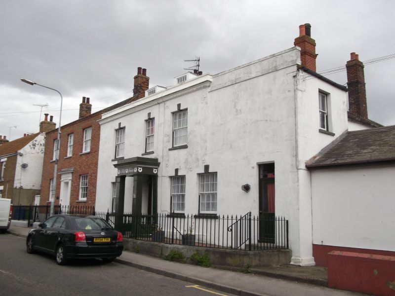
Mill House
TQ 97 SW 11/72
II GV
2.
C18 refaced in mid C19. 2 storeys attics and basement. Rendered facade.
Concealed hipped slate roof with dormers. Parapet with stone coping and cornice
with dentils. 3 sashes with glazing bars removed. Keystone. C19 porch with
moulded architrave and wreath decoration.
Listing NGR: TQ9100672256
External links are from the relevant listing authority and, where applicable, Wikidata. Wikidata IDs may be related buildings as well as this specific building. If you want to add or update a link, you will need to do so by editing the Wikidata entry.


Other nearby listed buildings