Approximate Location Map
Large Map »
Latitude: 51.3059 / 51°18'21"N
Longitude: 0.2307 / 0°13'50"E
OS Eastings: 555588
OS Northings: 158666
OS Grid: TQ555586
Mapcode National: GBR VS.GV3
Mapcode Global: VHHPL.YFBS
Plus Code: 9F32864J+87
Entry Name: Forecourt Wall to the St Edith's Hall
Listing Date: 16 January 1975
Grade: II
Source: Historic England
Source ID: 1258538
English Heritage Legacy ID: 444852
ID on this website: 101258538
Location: Kemsing, Sevenoaks, Kent, TN15
County: Kent
District: Sevenoaks
Civil Parish: Kemsing
Built-Up Area: Otford
Traditional County: Kent
Lieutenancy Area (Ceremonial County): Kent
Church of England Parish: Kemsing St Mary the Virgin
Church of England Diocese: Rochester
Tagged with: Wall
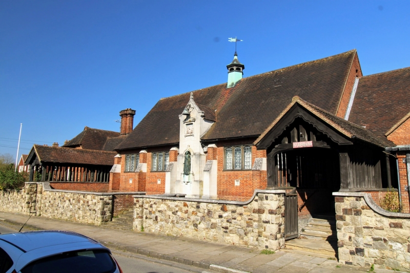
KEMSING KEMSING
1.
5280
High Street
(North Side)
Forecourt wall to
The St Edith's Hall
TQ 5558 16/566
II
2.
Early C20 wall of galletted large random rubble. Concrete coping ramped up
at entrances to 3 flights of stone steps, one rising to statue in centre, the
others to covered ways.
Listing NGR: TQ5558858666
External links are from the relevant listing authority and, where applicable, Wikidata. Wikidata IDs may be related buildings as well as this specific building. If you want to add or update a link, you will need to do so by editing the Wikidata entry.


Other nearby listed buildings
