Approximate Location Map
Large Map »
Latitude: 52.1786 / 52°10'42"N
Longitude: -2.181 / 2°10'51"W
OS Eastings: 387722
OS Northings: 253388
OS Grid: SO877533
Mapcode National: GBR 1GD.7G7
Mapcode Global: VH92V.4HWQ
Plus Code: 9C4V5RH9+CJ
Entry Name: The Elms
Listing Date: 11 February 1965
Grade: II
Source: Historic England
Source ID: 1258663
English Heritage Legacy ID: 445431
ID on this website: 101258663
Location: Swinesherd, Wychavon, Worcestershire, WR5
County: Worcestershire
District: Wychavon
Civil Parish: Whittington
Traditional County: Worcestershire
Lieutenancy Area (Ceremonial County): Worcestershire
Church of England Parish: Worcester, St Martin with St Peter and Whittington
Church of England Diocese: Worcester
Tagged with: Architectural structure
WHITTINGTON WHITTINGTON
1.
2301
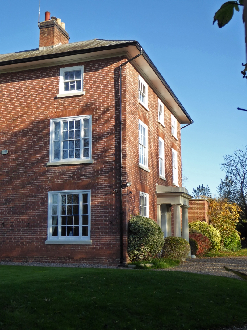
The Elms
SO 95 SE 4/870 11.2.65.
II
2.
Early C19 regular 3-storey house in red brick. 3 windows, the uppers reduced
in height. The lower windows are 3 lights. All have flat arches of rubbed
brick. Stuccoed Greek Doric cornice hood porch. Deep boarded eaves.
Listing NGR: SO8772253387
External links are from the relevant listing authority and, where applicable, Wikidata. Wikidata IDs may be related buildings as well as this specific building. If you want to add or update a link, you will need to do so by editing the Wikidata entry.


Other nearby listed buildings
