Latitude: 51.3261 / 51°19'34"N
Longitude: -2.0081 / 2°0'29"W
OS Eastings: 399533
OS Northings: 158559
OS Grid: ST995585
Mapcode National: GBR 2V6.WMG
Mapcode Global: VHB4G.4XRR
Plus Code: 9C3V8XGR+FQ
Entry Name: Dole Stone in Churchyard About 5 Metres North West of North Porch of Church of St Mary
Listing Date: 3 April 1987
Grade: II
Source: Historic England
Source ID: 1258970
English Heritage Legacy ID: 445963
ID on this website: 101258970
Location: St Mary's Church, Potterne, Wiltshire, SN10
County: Wiltshire
Civil Parish: Potterne
Built-Up Area: Potterne
Traditional County: Wiltshire
Lieutenancy Area (Ceremonial County): Wiltshire
Tagged with: Architectural structure
ST 9958 POTTERNE HIGH STREET (east side)
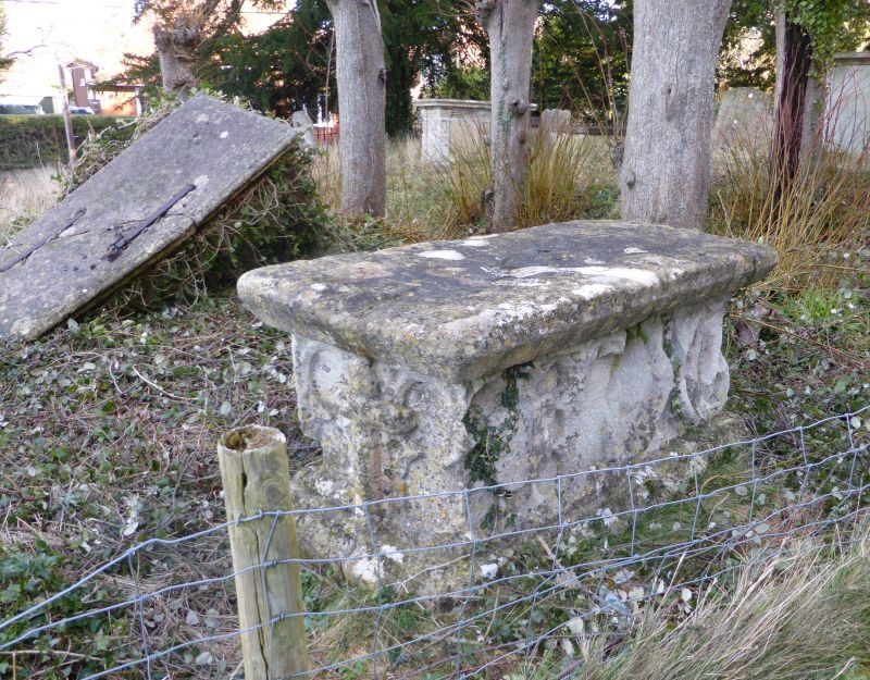
14/145 Dole stone in churchyard about 5m north-west of north porch of Church of St Mary
GV II
Dole stone for the distribution of alms, C15, ashlar. In form like a chest tomb with moulded base and heavy cap stone, the sides with deeply moulded stonework. At each end a cross on a quatrefoil. On south side a shield on an octofoil, a cusped panel, a cusped diagonal cross, and half of an octofoil with shield. On north side a cusped panel, a quatrefoil with cross, a cusped panel and a shield on octofoil. Possibly a chest tomb made up of C15 stonework.
Listing NGR: ST9953258556
External links are from the relevant listing authority and, where applicable, Wikidata. Wikidata IDs may be related buildings as well as this specific building. If you want to add or update a link, you will need to do so by editing the Wikidata entry.


Other nearby listed buildings