Approximate Location Map
Large Map »
Latitude: 51.3129 / 51°18'46"N
Longitude: 0.1898 / 0°11'23"E
OS Eastings: 552714
OS Northings: 159361
OS Grid: TQ527593
Mapcode National: GBR T3.4HX
Mapcode Global: VHHPL.78PD
Plus Code: 9F32857Q+4W
Entry Name: Wall to East of Boddington Bounding Garden of Mount View the Green
Listing Date: 16 January 1975
Grade: II
Source: Historic England
Source ID: 1259012
English Heritage Legacy ID: 446077
ID on this website: 101259012
Location: Otford, Sevenoaks, Kent, TN14
County: Kent
District: Sevenoaks
Civil Parish: Otford
Built-Up Area: Otford
Traditional County: Kent
Lieutenancy Area (Ceremonial County): Kent
Church of England Parish: Otford St Bartholomew
Church of England Diocese: Rochester
Tagged with: Wall
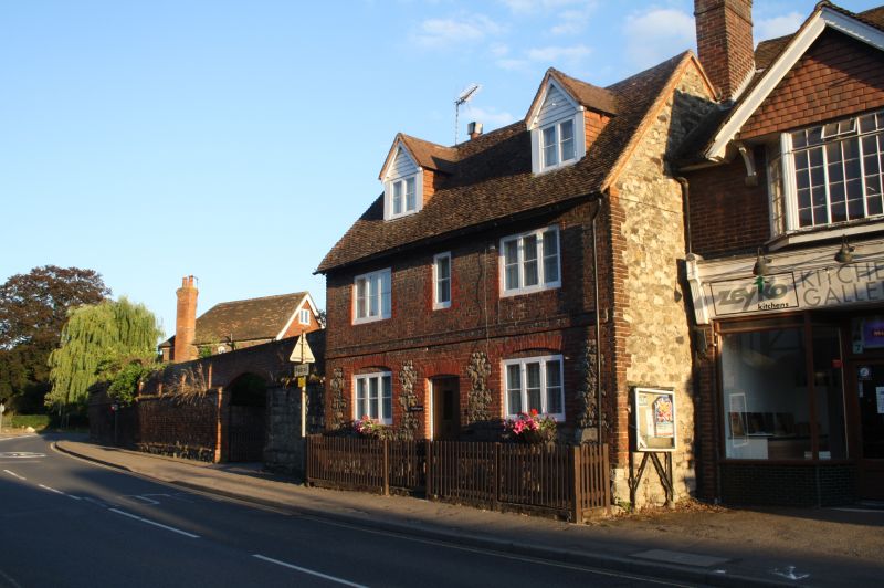
OTFORD OTFORD
1.
5280
High Street
(South side)
Wall to East of Boddington,
bounding garden of Mount View,
The Green
TQ 5259 21/773
II
2.
C18 brick wall, with rubble foundation possibly of earlier date, curving around
corner to The Green.
Listing NGR: TQ5271459360
External links are from the relevant listing authority and, where applicable, Wikidata. Wikidata IDs may be related buildings as well as this specific building. If you want to add or update a link, you will need to do so by editing the Wikidata entry.


Other nearby listed buildings
