Latitude: 53.2542 / 53°15'15"N
Longitude: -1.9255 / 1°55'31"W
OS Eastings: 405065
OS Northings: 373024
OS Grid: SK050730
Mapcode National: GBR GZZT.X5
Mapcode Global: WHBBS.DG9L
Plus Code: 9C5W733F+MQ
Entry Name: Numbers 9-12 Milnthorp Homes
Listing Date: 31 January 1997
Grade: II
Source: Historic England
Source ID: 1259187
English Heritage Legacy ID: 463160
ID on this website: 101259187
Location: River's Vale, High Peak, Derbyshire, SK17
County: Derbyshire
District: High Peak
Electoral Ward/Division: Temple
Parish: Non Civil Parish
Built-Up Area: Buxton
Traditional County: Derbyshire
Lieutenancy Area (Ceremonial County): Derbyshire
Church of England Parish: Buxton with Burbage and King Sterndale
Church of England Diocese: Derby
BUXTON
SK07SE MACCLESFIELD ROAD, Burbage 616-1/2/118 (North side) (Consecutive) Nos.9-12 Milnthorp Homes
GV II
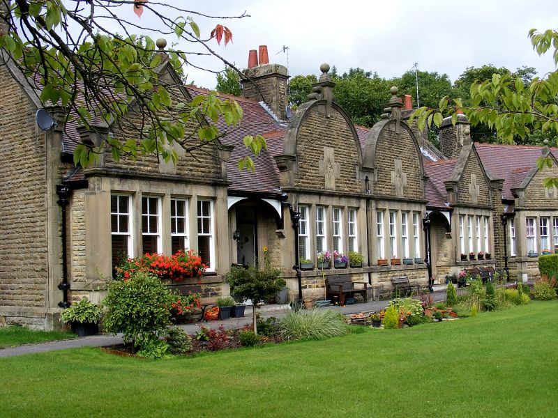
Four almshouses. 1904. Coursed rock-faced stone with ashlar dressings; plain tile roofs with terracotta ridge tiles. Raised coped gables with kneelers and stone stacks. EXTERIOR: single storey. Quoins and chamfered plinth. Main front has 4 windows arranged 1:2:1, each has a 4-light square bay window with sashes, the upper ones with glazing bars, and each topped with a stone gable. The outer gables are straight and the inner ones round, each with cross panels with quatrefoils, and all topped by ball finials. Between, 2 pairs of recessed doorways with glazed doors and overlights under segment arches. INTERIOR: not included. This block forms part of the Milnthorp Almshouses group.
Listing NGR: SK0506573024
External links are from the relevant listing authority and, where applicable, Wikidata. Wikidata IDs may be related buildings as well as this specific building. If you want to add or update a link, you will need to do so by editing the Wikidata entry.


Other nearby listed buildings