Latitude: 53.9572 / 53°57'25"N
Longitude: -1.0844 / 1°5'3"W
OS Eastings: 460174
OS Northings: 451624
OS Grid: SE601516
Mapcode National: GBR NQWP.06
Mapcode Global: WHFC3.9SVP
Plus Code: 9C5WXW48+V6
Entry Name: 1, Bridge Street
Listing Date: 24 June 1983
Grade: II
Source: Historic England
Source ID: 1259343
English Heritage Legacy ID: 462973
ID on this website: 101259343
Location: York, North Yorkshire, YO1
County: York
Electoral Ward/Division: Micklegate
Parish: Non Civil Parish
Built-Up Area: York
Traditional County: Yorkshire
Lieutenancy Area (Ceremonial County): North Yorkshire
Church of England Parish: Micklegate Holy Trinity
Church of England Diocese: York
Tagged with: Building
YORK
SE6051NW BRIDGE STREET 1112-1/28/118 (South side) 24/06/83 No.1
GV II
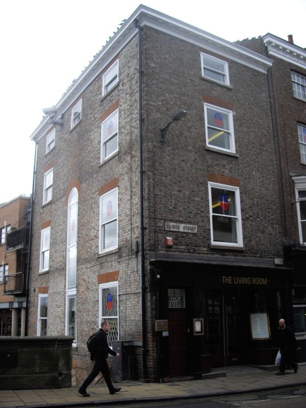
Shop and offices. 1815-1820, restored 1990. Probably by Peter Atkinson. Pink and white mottled brick in Flemish bond with orange brick dressings, on part-stone basement; moulded projecting eaves cornice with mutules, of timber. Hipped slate roof with orange ridge tiles, and two brick stacks, one at rear and one on ridge. EXTERIOR: 3 storeys and attic; 1 window front. Double shopfront of plain pilasters and frieze with moulded cornice. Left end door of six raised and fielded panels beneath overlight. Glazed shop door with overlight recessed between plate glass windows over panelled risers. Upper floor windows are 1-pane sashes, attic one squat, with flat arches. Left return: basement, 3 storeys and attic; 3 windows. Blocked doorway in basement. Tall round-arched staircase window with margin glazing rises through ground, first and second floors, flanked by flat-arched 1-pane sash windows on each floor. Attic windows squat 1-pane sashes with flat arches. All windows have renewed stone sills and arches of gauged brick. INTERIOR: staircase balustrade of slender turned balusters with square knops and moulded handrail. (City of York: RCHME: South-west of the Ouse: HMSO: 1972-: 124).
Listing NGR: SE6017451624
External links are from the relevant listing authority and, where applicable, Wikidata. Wikidata IDs may be related buildings as well as this specific building. If you want to add or update a link, you will need to do so by editing the Wikidata entry.


Other nearby listed buildings