Approximate Location Map
Large Map »
Latitude: 51.2742 / 51°16'27"N
Longitude: 1.0734 / 1°4'24"E
OS Eastings: 614462
OS Northings: 157275
OS Grid: TR144572
Mapcode National: GBR TY8.25R
Mapcode Global: VHLGM.K79H
Plus Code: 9F3373FF+M8
Entry Name: 15 and 17, Wincheap
Listing Date: 7 September 1973
Grade: II
Source: Historic England
Source ID: 1259801
English Heritage Legacy ID: 444106
ID on this website: 101259801
Location: Canterbury, Kent, CT1
County: Kent
District: Canterbury
Electoral Ward/Division: Wincheap
Parish: Non Civil Parish
Built-Up Area: Canterbury
Traditional County: Kent
Lieutenancy Area (Ceremonial County): Kent
Tagged with: Building
1.
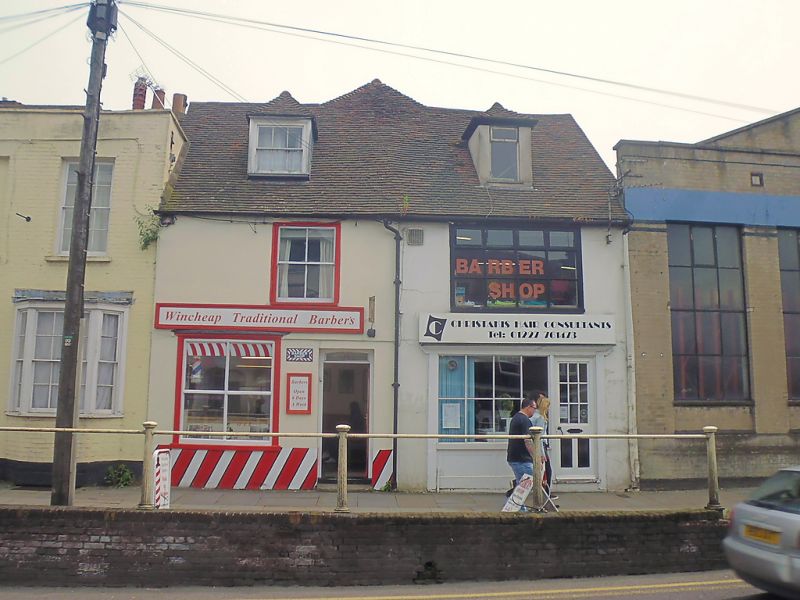
944 WINCHEAP
(South East Side)
Nos 15 and 17
TR 1457 SW 7/726
II GV
2.
Early C18 altered 2 storeys stuccoed. Tiled roof with 2 dormers. C19 sashes.
No 15 has an early C19 shop front and No 17 has a more recent shop fronts.
Nos 11 to 17 (odd) form a group.
Listing NGR: TR1446257275
External links are from the relevant listing authority and, where applicable, Wikidata. Wikidata IDs may be related buildings as well as this specific building. If you want to add or update a link, you will need to do so by editing the Wikidata entry.


Other nearby listed buildings
