Latitude: 52.7858 / 52°47'9"N
Longitude: -2.2817 / 2°16'54"W
OS Eastings: 381095
OS Northings: 320956
OS Grid: SJ810209
Mapcode National: GBR 05K.CYB
Mapcode Global: WH9CS.X7MM
Plus Code: 9C4VQPP9+88
Entry Name: Milepost Shropshire Union Canal 1.5 Miles to South of Norbury Junction
Listing Date: 10 January 1972
Grade: II
Source: Historic England
Source ID: 1259861
English Heritage Legacy ID: 443695
ID on this website: 101259861
Location: Coton, Stafford, Staffordshire, ST20
County: Staffordshire
District: Stafford
Civil Parish: Gnosall
Traditional County: Staffordshire
Lieutenancy Area (Ceremonial County): Staffordshire
Church of England Parish: Gnosall St Lawrence
Church of England Diocese: Lichfield
Tagged with: Milestone
GNOSALL
1.
2385
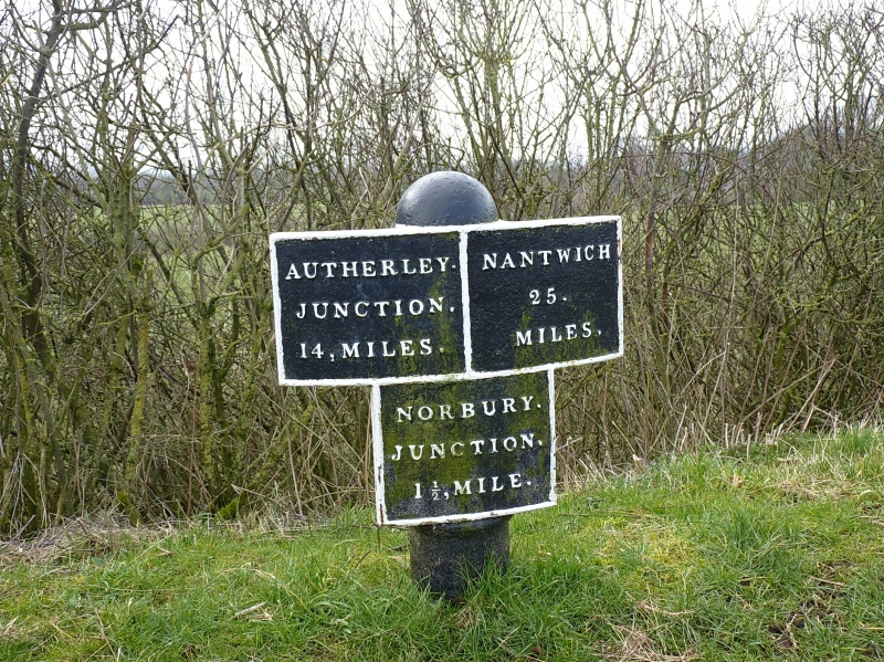
Milepost, Shropshire Union
Canal, l½ miles to south of
Norbury Junction
SJ 82 SW 13/14
II
2.
Circa 1835. Painted castiron. A short post with convex plate and lower
panel giving distances from Autherley, Nantwich and Norbury Junction.
Listing NGR: SJ8109520955
External links are from the relevant listing authority and, where applicable, Wikidata. Wikidata IDs may be related buildings as well as this specific building. If you want to add or update a link, you will need to do so by editing the Wikidata entry.


Other nearby listed buildings