Latitude: 53.3935 / 53°23'36"N
Longitude: -2.0599 / 2°3'35"W
OS Eastings: 396111
OS Northings: 388523
OS Grid: SJ961885
Mapcode National: GBR GY16.T7
Mapcode Global: WHB9Y.BYBT
Plus Code: 9C5V9WVR+C2
Entry Name: Marple Locks Number 15 and Adjoining Footbridge on Peak Forest Canal
Listing Date: 11 October 1985
Grade: II
Source: Historic England
Source ID: 1260016
English Heritage Legacy ID: 441848
ID on this website: 101260016
Location: Marple, Stockport, Greater Manchester, SK6
County: Stockport
Electoral Ward/Division: Marple South
Parish: Non Civil Parish
Built-Up Area: Marple
Traditional County: Cheshire
Lieutenancy Area (Ceremonial County): Greater Manchester
Church of England Parish: Marple All Saints
Church of England Diocese: Chester
Tagged with: Lock Architectural structure Footbridge
SJ 98 NE MARPLE PEAK FOREST CANAL
7/144 Marple Locks No. 15 and ad- joining foot- - bridge
G.V. II
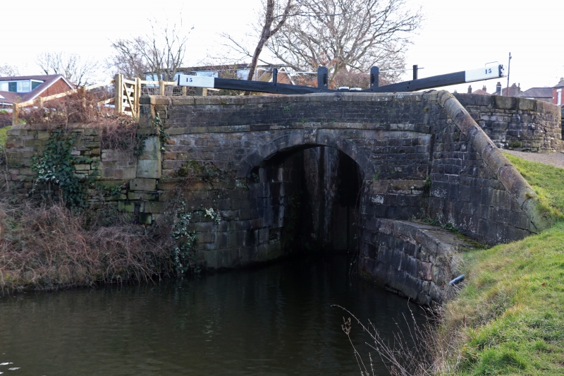
Lock and adjoining footbridge. 1803 to 1805. Benjamin Outram and Thomas Brown engineers, financed by S. Oldknow and R. Arkwright and built by James and Fox. Dressed stone and ashlar. Single upper gate, double lower gate and footbridge at lower end. 4m. pound-to-pound level to accommodate steepness of slope. Lock walls in large coursed stone blocks with rounded verge. The mouth is grooved for stop planks. The footbridge has a segmental rusticated keystone arch, an ashlar band and parapet walls with rounded copings which are terminated by a battered square pier at one end with a small abutting flight of steps, and sweeps down at the other end to the level of the pound.
Listing NGR: SJ9611188522
External links are from the relevant listing authority and, where applicable, Wikidata. Wikidata IDs may be related buildings as well as this specific building. If you want to add or update a link, you will need to do so by editing the Wikidata entry.


Other nearby listed buildings