Approximate Location Map
Large Map »
Latitude: 53.3842 / 53°23'2"N
Longitude: -2.0127 / 2°0'45"W
OS Eastings: 399249
OS Northings: 387479
OS Grid: SJ992874
Mapcode National: GBR GYD9.1L
Mapcode Global: WHBB5.16TG
Plus Code: 9C5V9XMP+MW
Entry Name: Cross Base
Listing Date: 11 October 1985
Grade: II
Source: Historic England
Source ID: 1260017
English Heritage Legacy ID: 441852
ID on this website: 101260017
Location: High Peak, Derbyshire, SK6
County: Derbyshire
District: High Peak
Civil Parish: New Mills
Traditional County: Derbyshire
Lieutenancy Area (Ceremonial County): Derbyshire
Church of England Parish: Mellor
Church of England Diocese: Chester
Tagged with: Cross base
SJ 98 NE MARPLE PRIMROSE LANE
(north-east side)
Mellor Moor
7/148 Cross Base
-
- II
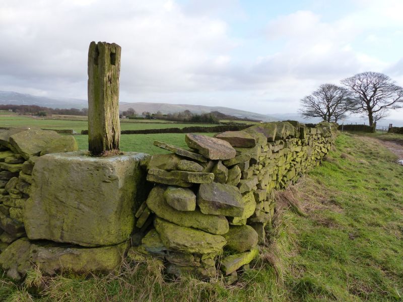
Cross base now forming the base to a sign post. Medieval
origin. Stone. Roughly a cube in shape with a recess in
the top face. A wall now abuts it on 2 sides and a timber
post acts as sign post.
Listing NGR: SJ9924987479
External links are from the relevant listing authority and, where applicable, Wikidata. Wikidata IDs may be related buildings as well as this specific building. If you want to add or update a link, you will need to do so by editing the Wikidata entry.


Other nearby listed buildings
