Latitude: 51.357 / 51°21'25"N
Longitude: -0.4864 / 0°29'11"W
OS Eastings: 505487
OS Northings: 163078
OS Grid: TQ054630
Mapcode National: GBR 1J.81P
Mapcode Global: VHFV3.J562
Plus Code: 9C3X9G47+QC
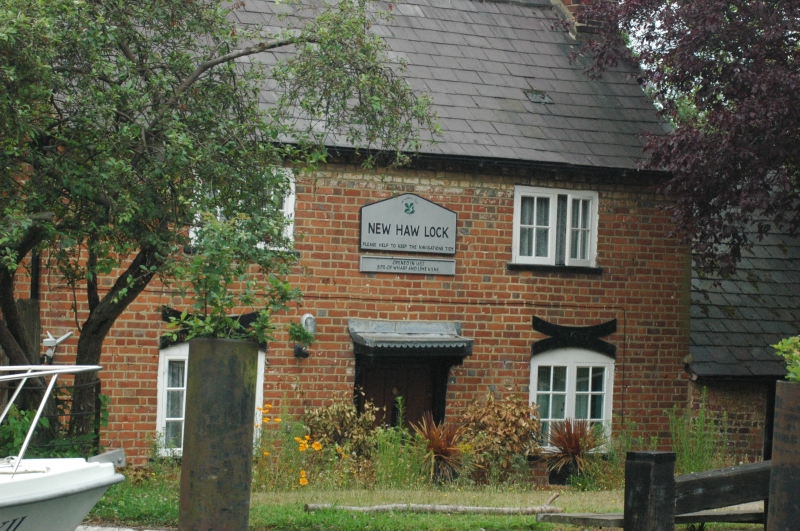
Entry Name: New Haw Lock Cottage
Listing Date: 23 September 1975
Grade: II
Source: Historic England
Source ID: 1260102
English Heritage Legacy ID: 361740
ID on this website: 101260102
Location: Runnymede, Surrey, KT15
County: Surrey
District: Runnymede
Electoral Ward/Division: New Haw
Parish: Non Civil Parish
Built-Up Area: Woking
Traditional County: Surrey
Lieutenancy Area (Ceremonial County): Surrey
Church of England Parish: New Haw
Church of England Diocese: Guildford
Tagged with: Cottage
NEW HAW 966 ADDLESTONE New Haw Lock Cottage TQ 06 SE 6/126
II
2. Probably early C19. Two storeys, red brick. Two casements. Slate roof. Central door with flat hood on brackets. Gable ends with stacks. Associated with the Wey Navigation, the first canal in the country.
Listing NGR: TQ0548763078
External links are from the relevant listing authority and, where applicable, Wikidata. Wikidata IDs may be related buildings as well as this specific building. If you want to add or update a link, you will need to do so by editing the Wikidata entry.


Other nearby listed buildings