Approximate Location Map
Large Map »
Latitude: 51.2774 / 51°16'38"N
Longitude: 1.0936 / 1°5'36"E
OS Eastings: 615857
OS Northings: 157687
OS Grid: TR158576
Mapcode National: GBR TY3.THX
Mapcode Global: VHLGM.W5Z2
Plus Code: 9F3373GV+XC
Entry Name: 9, St Martin's Hill
Listing Date: 3 May 1967
Grade: II
Source: Historic England
Source ID: 1260150
English Heritage Legacy ID: 441531
ID on this website: 101260150
Location: St Martin's, Canterbury, Kent, CT1
County: Kent
District: Canterbury
Electoral Ward/Division: Barton
Parish: Non Civil Parish
Built-Up Area: Canterbury
Traditional County: Kent
Lieutenancy Area (Ceremonial County): Kent
Tagged with: Building
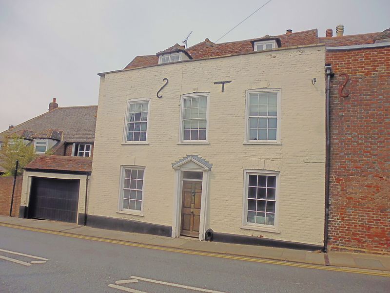
1.
944 ST MARTIN'S HILL
No 9
TR 1557 NE 6/163 3.5.67.
II GV
2.
C18. 2 storeys painted brick. Old tiled roof with 2 hipped dormers. 3 cambered
sashes with glazing bars intact. Braces. Shutters to ground floor windows.
Doorcase has wooden pediment, pilasters, rectangular fanlight and door with
6 fielded panels.
Nos 1 to 13 (odd) form a group.
Listing NGR: TR1585657689
External links are from the relevant listing authority and, where applicable, Wikidata. Wikidata IDs may be related buildings as well as this specific building. If you want to add or update a link, you will need to do so by editing the Wikidata entry.


Other nearby listed buildings
