Approximate Location Map
Large Map »
Latitude: 51.2783 / 51°16'42"N
Longitude: 1.0799 / 1°4'47"E
OS Eastings: 614901
OS Northings: 157750
OS Grid: TR149577
Mapcode National: GBR TY2.XG8
Mapcode Global: VHLGM.N4SC
Plus Code: 9F3373HH+8X
Entry Name: 30, St Margaret's Street
Listing Date: 3 May 1967
Grade: II
Source: Historic England
Source ID: 1260191
English Heritage Legacy ID: 441201
ID on this website: 101260191
Location: Canterbury, Kent, CT1
County: Kent
District: Canterbury
Electoral Ward/Division: Westgate
Parish: Non Civil Parish
Built-Up Area: Canterbury
Traditional County: Kent
Lieutenancy Area (Ceremonial County): Kent
Tagged with: Building
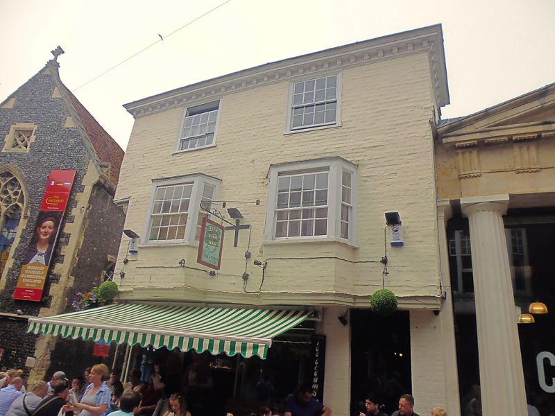
1.
944 ST MARGARET'S STREET
(North West Side)
No 30
TR 1457 NE 4/198 3.5.67.
II GV
2.
C18. 3 storeys painted brick. Old hipped tiled roof. Wooden bracket cornice.
2 C18 sashes with glazing bars intact. 2 3-light canted bays on 1st floor.
Overhang to C19 shopfront. Side elevation has a canted bay and doorcase with
weatherhood and brackets.
Nos 27 to 36 (consec) and Church of St Margaret form a group.
Listing NGR: TR1489857750
External links are from the relevant listing authority and, where applicable, Wikidata. Wikidata IDs may be related buildings as well as this specific building. If you want to add or update a link, you will need to do so by editing the Wikidata entry.


Other nearby listed buildings
