Approximate Location Map
Large Map »
Latitude: 51.2784 / 51°16'42"N
Longitude: 1.0809 / 1°4'51"E
OS Eastings: 614970
OS Northings: 157754
OS Grid: TR149577
Mapcode National: GBR TY2.XR9
Mapcode Global: VHLGM.P49B
Plus Code: 9F3373HJ+89
Entry Name: 12, the Parade
Listing Date: 7 September 1973
Grade: II
Source: Historic England
Source ID: 1260402
English Heritage Legacy ID: 440820
ID on this website: 101260402
Location: Canterbury, Kent, CT1
County: Kent
District: Canterbury
Electoral Ward/Division: Westgate
Parish: Non Civil Parish
Built-Up Area: Canterbury
Traditional County: Kent
Lieutenancy Area (Ceremonial County): Kent
Tagged with: Building
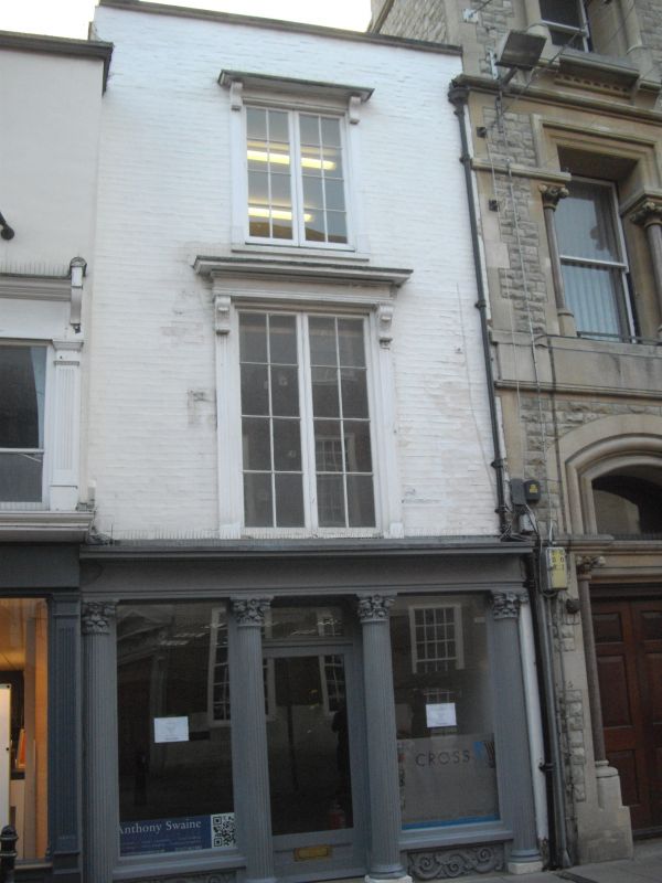
1.
944 THE PARADE
(South West Side)
No 12
TR 1457 NE 4/61A
II GV
2.
Mediaeval interior refaced in C18. 3 storeys painted brick. Hipped old tiled
roof, 1 window set in Italianate architrave. Fine later Victorian shopfront
having a cornice with modillions, 4 fluted composite columns and scrolled
risers.
Nos 12 & 13 form a group.
Listing NGR: TR1496757750
External links are from the relevant listing authority and, where applicable, Wikidata. Wikidata IDs may be related buildings as well as this specific building. If you want to add or update a link, you will need to do so by editing the Wikidata entry.


Other nearby listed buildings
