Latitude: 51.28 / 51°16'48"N
Longitude: 1.0804 / 1°4'49"E
OS Eastings: 614926
OS Northings: 157941
OS Grid: TR149579
Mapcode National: GBR TY2.PZ6
Mapcode Global: VHLGM.P301
Plus Code: 9F3373JJ+25
Entry Name: Seven Stars Hotel
Listing Date: 7 September 1973
Grade: II
Source: Historic England
Source ID: 1260531
English Heritage Legacy ID: 440407
ID on this website: 101260531
1.
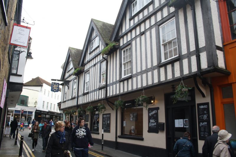
944 ORANGE STREET
(South East Side)
No 1
(Seven Stars Hotel)
TR 1457 NE 4/621
II GV
2.
Probably a genuine timber-framed building refronted. 2 storeys and attic
gables. Ground floor stuccoed. Upper floors are imitation timber-framed
and plastered. 6 sashes in all with casements in the gables. Ground floor
has an early C19 pub front.
No 1 and Nos 4 to 7 (consec) form a group.
Listing NGR: TR1491657937
External links are from the relevant listing authority and, where applicable, Wikidata. Wikidata IDs may be related buildings as well as this specific building. If you want to add or update a link, you will need to do so by editing the Wikidata entry.


Other nearby listed buildings