Approximate Location Map
Large Map »
Latitude: 50.9324 / 50°55'56"N
Longitude: -2.7011 / 2°42'4"W
OS Eastings: 350824
OS Northings: 115009
OS Grid: ST508150
Mapcode National: GBR ML.PFH7
Mapcode Global: FRA 567N.1HF
Plus Code: 9C2VW7JX+XG
Entry Name: Stone at Ngr St 5082 1501
Listing Date: 27 October 1987
Grade: II
Source: Historic England
Source ID: 1260554
English Heritage Legacy ID: 440368
ID on this website: 101260554
Location: Odcombe, Somerset, BA22
County: Somerset
District: South Somerset
Civil Parish: Odcombe
Built-Up Area: Odcombe
Traditional County: Somerset
Lieutenancy Area (Ceremonial County): Somerset
Tagged with: Milestone Architectural structure
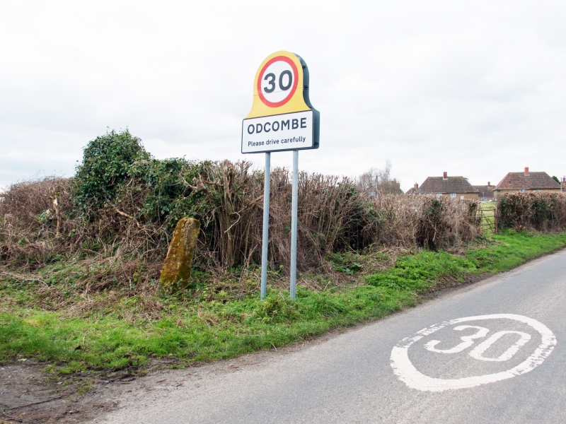
ST5015 ODCOMBE CP CAMP ROAD (South side)
10/237 Stone at NGR ST 5082 1501
-
- II
Milestone or direction stone. Probably C18. Ham stone pillar about 450 mm
wide; 300 mm thick, tapering to 200 mm; about 1.4 metres tall; flat top. Apparently once inscribed - the word 'mile' barely decipherable: possibly
a relic of the pre-1800 London-Exeter road.
Listing NGR: ST5082415009
External links are from the relevant listing authority and, where applicable, Wikidata. Wikidata IDs may be related buildings as well as this specific building. If you want to add or update a link, you will need to do so by editing the Wikidata entry.


Other nearby listed buildings
