Latitude: 51.2835 / 51°17'0"N
Longitude: 1.0859 / 1°5'9"E
OS Eastings: 615291
OS Northings: 158338
OS Grid: TR152583
Mapcode National: GBR TY2.KBB
Mapcode Global: VHLGF.RZXZ
Plus Code: 9F3373MP+98
Entry Name: 109-111, Northgate
Listing Date: 7 September 1973
Grade: II
Source: Historic England
Source ID: 1260669
English Heritage Legacy ID: 440037
ID on this website: 101260669
Location: Northgate, Canterbury, Kent, CT1
County: Kent
District: Canterbury
Electoral Ward/Division: Northgate
Parish: Non Civil Parish
Built-Up Area: Canterbury
Traditional County: Kent
Lieutenancy Area (Ceremonial County): Kent
Tagged with: Building
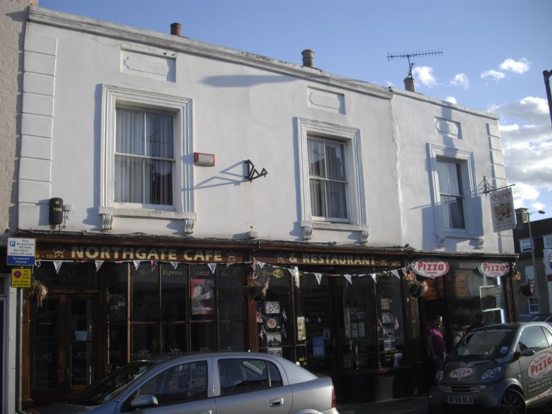
1.
944 NORTHGATE
(South East Side)
Nos 109 to 111 (consec)
TR 1558 SW 3/598
II GV
2.
Early C19. 2 storeys stuccoed. Parapet and end quoins. 3 sashes with verticals
only set in moulded architraves with blank recesses above. Nos 11O and 111
have early C19 shop fronts. No 109 has a modern shop front.
Nos 109 to 114 (consec) and No 114A form a group.
Listing NGR: TR1529058333
External links are from the relevant listing authority and, where applicable, Wikidata. Wikidata IDs may be related buildings as well as this specific building. If you want to add or update a link, you will need to do so by editing the Wikidata entry.


Other nearby listed buildings