Approximate Location Map
Large Map »
Latitude: 51.2825 / 51°16'57"N
Longitude: 1.0764 / 1°4'35"E
OS Eastings: 614637
OS Northings: 158202
OS Grid: TR146582
Mapcode National: GBR TY2.GZF
Mapcode Global: VHLGM.L1X5
Plus Code: 9F3373MG+2H
Entry Name: 10 and 11, North Lane
Listing Date: 7 September 1973
Grade: II
Source: Historic England
Source ID: 1260680
English Heritage Legacy ID: 440060
ID on this website: 101260680
Location: Canterbury, Kent, CT2
County: Kent
District: Canterbury
Electoral Ward/Division: Westgate
Parish: Non Civil Parish
Built-Up Area: Canterbury
Traditional County: Kent
Lieutenancy Area (Ceremonial County): Kent
Tagged with: Building
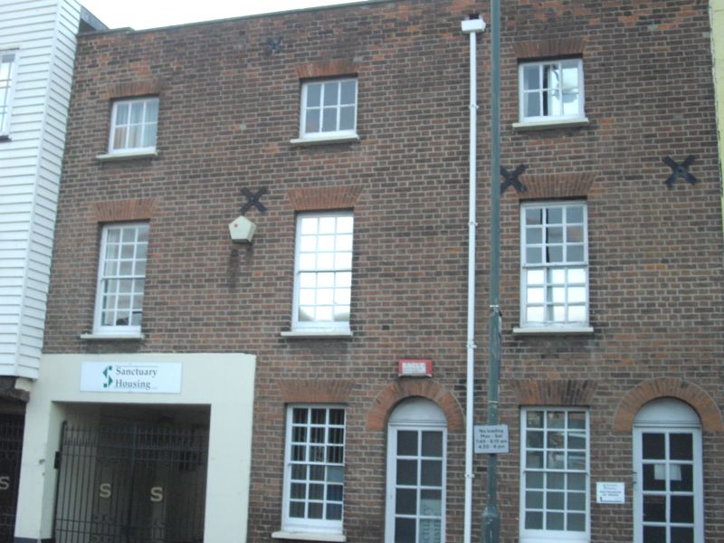
1.
944 NORTH LANE
(North West Side)
Nos 10 & 11
TR 1458 SE 2/346
II GV
2.
C18 heavily restored. 3 storeys red brick. Coping. 2nd floor has 3 casements.
1st floor has 3 sashes. Ground floor has 2 round-headed doorcases and a garage
entrance.
Nos 1, 2 & Nos 4 to 15 (consec) form a group.
Listing NGR: TR1463358205
External links are from the relevant listing authority and, where applicable, Wikidata. Wikidata IDs may be related buildings as well as this specific building. If you want to add or update a link, you will need to do so by editing the Wikidata entry.


Other nearby listed buildings
