Approximate Location Map
Large Map »
Latitude: 51.2769 / 51°16'36"N
Longitude: 1.0862 / 1°5'10"E
OS Eastings: 615348
OS Northings: 157611
OS Grid: TR153576
Mapcode National: GBR TY2.ZBX
Mapcode Global: VHLGM.S53F
Plus Code: 9F3373GP+QF
Entry Name: 53-57, Ivy Lane
Listing Date: 7 September 1973
Grade: II
Source: Historic England
Source ID: 1260830
English Heritage Legacy ID: 439383
ID on this website: 101260830
Location: Canterbury, Kent, CT1
County: Kent
District: Canterbury
Electoral Ward/Division: Barton
Parish: Non Civil Parish
Built-Up Area: Canterbury
Traditional County: Kent
Lieutenancy Area (Ceremonial County): Kent
Tagged with: Building
1.
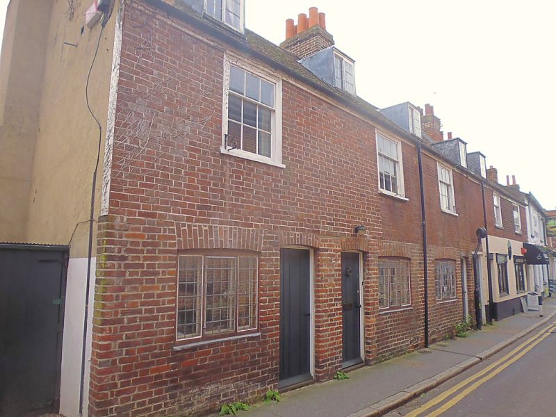
944 IVY LANE
(South Side)
Nos 53 to 57 (consec)
iR 1557 NW 5/518
II GV
2.
C18. 2 storeys red brick. Half-hipped roof with 5 dormers. 5 sashes with
glazing bars intact. Ground floors have simple cambered sashes with shopfronts
to Nos 56 and 57 and simple doorcases. Grade II as a group.
Nos 40A to 45 (consec), No 51, No 51A, Nos 53 to 61 (consec) and
No 63 form a group.
Listing NGR: TR1533557608
External links are from the relevant listing authority and, where applicable, Wikidata. Wikidata IDs may be related buildings as well as this specific building. If you want to add or update a link, you will need to do so by editing the Wikidata entry.


Other nearby listed buildings
